
– Lat/Long: 45.80° N 110.90° W
 Saddle Peak-MT
Weather Forecast, United StatesIssued: 5 pm Tue 09 Jun Local TimeUpdates in: hr min sUpdate imminent
Issued: 5 pm Tue 09 Jun Local Time
Updates in:
Update imminent hr min s

Issued: 5 pm Tue 09 Jun Local Time
Updates in:
Update imminent hr min s
Days 1–4 Weather SummaryLight rain (total 4mm) at first, then becoming colder with a dusting of snow on Tue night. Freeze-thaw conditions (max 7°C on Thu afternoon, min -4°C on Tue night). Winds decreasing (near gales from the W on Tue night, light winds from the W by Thu night). | Days 5–7 Weather SummaryA heavy fall of snow, heaviest during Sat night. Freeze-thaw conditions (max 9°C on Fri afternoon, min -3°C on Sat night). Mainly fresh winds. | ||||||||||||||||
Tue 9 | Wednesday 10 | Thursday 11 | Friday 12 | Saturday 13 | Sunday 14 | ||||||||||||
PM | night | AM | PM | night | AM | PM | night | AM | PM | night | AM | PM | night | AM | PM | night | |
light rain | snow shwrs | some clouds | cloudy | light snow | clear | clear | clear | clear | some clouds | some clouds | light rain | light rain | heavy snow | light snow | cloudy | clear | |
km/h | |||||||||||||||||
 |  |  |  |  |  | ||||||||||||
— | 1 | — | — | 1 | — | — | — | — | — | — | — | — | 22 | 4 | — | — | |
4 | — | — | — | — | — | — | — | — | — | — | 0.4 | 0.2 | — | — | — | — | |
max °C | 3 | 0 | -2 | -1 | -2 | 2 | 7 | 7 | 6 | 9 | 7 | 2 | 2 | 0 | -3 | -1 | -1 |
min °C | 2 | -4 | -4 | -2 | -3 | -1 | 5 | 4 | 5 | 8 | 2 | 2 | 1 | -3 | -3 | -2 | -2 |
-5 | -14 | -14 | -11 | -12 | -7 | 0 | -1 | 0 | 4 | -1 | 2 | -4 | -10 | -10 | -7 | -8 | |
3250 | 2600 | 2400 | 2700 | 2300 | 2650 | 3400 | 3650 | 3450 | 3850 | 3800 | 3100 | 3150 | 2300 | 2150 | 2550 | 2500 | |
Cloud base (m) | 3000 | 2600 | 2800 | 2800 | 2150 | 2300 | 4500 | 8750 | 4100 | 2450 | 2350 | 1700 | 1650 | 1700 | 1850 | ||
— | — | 5:33 | — | — | 5:33 | — | — | 5:33 | — | — | 5:33 | — | — | 5:33 | — | — | |
— | 9:10 | — | — | 9:12 | — | — | 9:13 | — | — | 9:13 | — | — | 9:14 | — | — | 9:14 | |
Loading...
Saddle Peak-MT Weather (Days 0-3):
The weather forecast for Saddle Peak-MT is: Light rain (total 4mm) at first, then becoming colder with a dusting of snow on Tue night. Freeze-thaw conditions (max 7°C on Thu afternoon, min -4°C on Tue night). Winds decreasing (near gales from the W on Tue night, light winds from the W by Thu night).
Saddle Peak-MT Weather (Days 3-6):
A heavy fall of snow, heaviest during Sat night. Freeze-thaw conditions (max 9°C on Fri afternoon, min -3°C on Sat night). Mainly fresh winds.
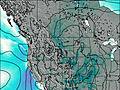
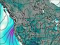
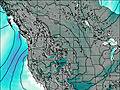
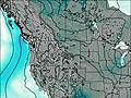
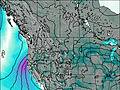
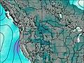
This table gives the weather forecast for Saddle Peak-MT at the specific elevation of 2793 m. Our advanced weather models allow us to provide distinct weather forecasts for several elevations of Saddle Peak-MT. To see the weather forecasts for the other elevations, use the tab navigation above the table. For a wider overview of the weather, consult the Weather Map of Montana.
| Weather Station | Temp. | Weather | Wind | Gusts | Cloud / Visibility |
|---|---|---|---|---|---|
Livingston Airport | |||||
* NOTE: not all weather observatories update at the same frequency which is the reason why some locations may show data from stations that are further away than known closer ones.