
– Lat/Long: 41.53° N 21.68° E
 Ruen
Ruen
Weather Forecast, Rep. of N. MacedoniaIssued: 1 pm Wed 10 Jun Local TimeUpdates in: hr min sUpdate imminent
Issued: 1 pm Wed 10 Jun Local Time
Updates in:
Update imminent hr min s

Issued: 1 pm Wed 10 Jun Local Time
Updates in:
Update imminent hr min s
Days 1–4 Weather SummaryModerate rain (total 16mm), heaviest on Wed night. Very mild (max 12°C on Wed afternoon, min 4°C on Sat morning). Winds increasing (calm on Wed afternoon, fresh winds from the N by Fri night). | Days 5–7 Weather SummaryMostly dry. Very mild (max 12°C on Mon afternoon, min 4°C on Sat night). Winds decreasing (fresh winds from the N on Sat night, calm by Tue morning). | ||||||||||||||||
Wed 10 | Thursday 11 | Friday 12 | Saturday 13 | Sunday 14 | Monday 15 | ||||||||||||
PM | night | AM | PM | night | AM | PM | night | AM | PM | night | AM | PM | night | AM | PM | night | |
risk tstorm | rain shwrs | clear | risk tstorm | rain shwrs | light rain | some clouds | clear | clear | clear | clear | clear | rain shwrs | clear | clear | clear | clear | |
km/h | |||||||||||||||||
 |  |  |  |  |  | ||||||||||||
— | — | — | — | — | — | — | — | — | — | — | — | — | — | — | — | — | |
0.5 | 9 | — | 0.1 | 6 | 0.3 | — | — | — | — | — | — | 0.1 | — | — | — | — | |
max °C | 12 | 12 | 10 | 12 | 12 | 6 | 6 | 6 | 5 | 6 | 6 | 6 | 8 | 9 | 10 | 12 | 12 |
min °C | 12 | 10 | 10 | 12 | 7 | 5 | 6 | 5 | 4 | 6 | 4 | 4 | 7 | 9 | 9 | 11 | 10 |
12 | 9 | 10 | 12 | 3 | 2 | 3 | 0 | -1 | 2 | -2 | -1 | 3 | 6 | 7 | 10 | 9 | |
3750 | 3950 | 3850 | 3700 | 3650 | 3350 | 3250 | 3250 | 3150 | 3100 | 3000 | 3100 | 3350 | 3750 | 3800 | 3700 | 3750 | |
Cloud base (m) | 2950 | 4000 | 850 | 1550 | 2800 | 2650 | 2850 | 1850 | |||||||||
— | — | 4:58 | — | — | 4:58 | — | — | 4:58 | — | — | 4:58 | — | — | 4:58 | — | — | |
— | 8:06 | — | — | 8:06 | — | — | 8:07 | — | — | 8:07 | — | — | 8:07 | — | — | 8:07 | |
Loading...
Ruen Weather (Days 0-3):
The weather forecast for Ruen is: Moderate rain (total 16mm), heaviest on Wed night. Very mild (max 12°C on Wed afternoon, min 4°C on Sat morning). Winds increasing (calm on Wed afternoon, fresh winds from the N by Fri night).
Ruen Weather (Days 3-6):
Mostly dry. Very mild (max 12°C on Mon afternoon, min 4°C on Sat night). Winds decreasing (fresh winds from the N on Sat night, calm by Tue morning).
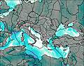
This table gives the weather forecast for Ruen at the specific elevation of 2250 m. Our advanced weather models allow us to provide distinct weather forecasts for several elevations of Ruen. To see the weather forecasts for the other elevations, use the tab navigation above the table. For a wider overview of the weather, consult the Weather Map of Macedonia.
| Weather Station | Temp. | Weather | Wind | Gusts | Cloud / Visibility |
|---|---|---|---|---|---|
thunderstorm affecting Bogomila | |||||
Kavadarci | |||||
lightning 22km E of Perlepe | |||||
lightning 24km SSW of Vatasa | |||||
lightning 11km SW of Shtip | |||||
Kruševo | |||||
Guriste | |||||
lightning 23km E of Kanatlarci |
* NOTE: not all weather observatories update at the same frequency which is the reason why some locations may show data from stations that are further away than known closer ones.