
– Lat/Long: 68.53° N 15.45° E
 Møysalen (Moysalen)
Weather Forecast, NorwayIssued: 1 am Tue 09 Jun Local TimeUpdates in: hr min sUpdate imminent
Issued: 1 am Tue 09 Jun Local Time
Updates in:
Update imminent hr min s

Issued: 1 am Tue 09 Jun Local Time
Updates in:
Update imminent hr min s
Days 1–3 Weather SummaryLight rain (total 2mm), mostly falling on Wed night. Very mild (max 13°C on Wed afternoon, min 1°C on Thu morning). Winds increasing (light winds from the SSE on Tue morning, strong winds from the SW by Thu morning). | Days 4–6 Weather SummaryLight rain (total 4mm), mostly falling on Sun afternoon. Mild temperatures (max 5°C on Fri morning, min 1°C on Sun night). Winds increasing (light winds from the SSE on Fri afternoon, fresh winds from the SSW by Sat morning). | |||||||||||||||||
Tuesday 9 | Wednesday 10 | Thursday 11 | Friday 12 | Saturday 13 | Sunday 14 | |||||||||||||
AM | PM | night | AM | PM | night | AM | PM | night | AM | PM | night | AM | PM | night | AM | PM | night | |
clear | some clouds | clear | clear | clear | light rain | cloudy | clear | some clouds | rain shwrs | light rain | rain shwrs | light rain | light rain | rain shwrs | cloudy | rain shwrs | some clouds | |
km/h | ||||||||||||||||||
 |  |  |  |  |  | |||||||||||||
— | — | — | — | — | — | — | — | — | — | — | — | — | — | — | — | — | — | |
— | — | — | — | — | 2 | — | — | — | 0.2 | 0.6 | 0.1 | 0.8 | 0.6 | 0.3 | — | 0.9 | — | |
max °C | 11 | 12 | 12 | 12 | 13 | 9 | 1 | 3 | 6 | 5 | 3 | 4 | 3 | 3 | 3 | 2 | 2 | 2 |
min °C | 10 | 11 | 11 | 11 | 11 | 2 | 1 | 1 | 5 | 4 | 2 | 3 | 2 | 3 | 2 | 2 | 2 | 1 |
8 | 9 | 9 | 9 | 8 | -4 | -6 | -5 | 2 | 2 | -1 | 0 | -4 | -3 | -1 | -2 | -2 | -3 | |
2650 | 2750 | 2750 | 2750 | 2700 | 2100 | 1400 | 1650 | 2100 | 1850 | 1650 | 1900 | 1600 | 1700 | 1550 | 1550 | 1550 | 1550 | |
Cloud base (m) | 2650 | 2350 | 2700 | 2250 | 1850 | 400 | 2100 | 700 | 250 | 1650 | 250 | 600 | 600 | 300 | 300 | 650 | ||
12:00 | — | — | 12:00 | — | — | 12:00 | — | — | 12:00 | — | — | 12:00 | — | — | 12:00 | — | — | |
12:00 | — | — | 12:00 | — | — | 12:00 | — | — | 12:00 | — | — | 12:00 | — | — | 12:00 | — | — | |
Loading...
Møysalen Weather (Days 0-3):
The weather forecast for Møysalen is: Light rain (total 2mm), mostly falling on Wed night. Very mild (max 13°C on Wed afternoon, min 1°C on Thu morning). Winds increasing (light winds from the SSE on Tue morning, strong winds from the SW by Thu morning).
Møysalen Weather (Days 3-6):
Light rain (total 4mm), mostly falling on Sun afternoon. Mild temperatures (max 5°C on Fri morning, min 1°C on Sun night). Winds increasing (light winds from the SSE on Fri afternoon, fresh winds from the SSW by Sat morning).
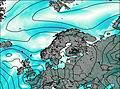
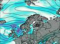
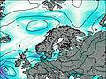
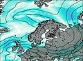
This table gives the weather forecast for Møysalen at the specific elevation of 1262 m. Our advanced weather models allow us to provide distinct weather forecasts for several elevations of Møysalen. To see the weather forecasts for the other elevations, use the tab navigation above the table. For a wider overview of the weather, consult the Weather Map of Norway.
| Weather Station | Temp. | Weather | Wind | Gusts | Cloud / Visibility |
|---|---|---|---|---|---|
Stokmarknes AP | |||||
Rotvaer | |||||
Bø (Vesteralen) | |||||
Svolvær lufthav / elle Airport | |||||
Harstad Modellflyklu | |||||
HPGT Samaåsen | |||||
Evenes AP | |||||
Skrova LH |
* NOTE: not all weather observatories update at the same frequency which is the reason why some locations may show data from stations that are further away than known closer ones.