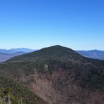
Mount Whiteface Climbing notes shared by Mountain-Forecast users
Click here to submit your own climbing note for Mount Whiteface
(NOTE: Texts may be edited by our content team for the purposes of ensuring accurate and relevant information)
-
June 23, 2018
RickNH from United States
Hiked up the blueberry Ridge Trail to Whiteface over to Passaconaway, then down Dicey's mill. At 2.0 miles is the junction to the Cutoff which I recommend taking over the Blueberry Ledge trail to this point. The cutoff is a bit steep at the end but is a nicer trail. They seems to have put some switch backs in that were not on my mapping GPS which was nice. Another route up is the Tom Wiggins trail that is not recommended due to steep and loose footing (It is mentioned on the trail markers at the terminus and head.) The last 1/2 mile or so of Blueberry ledge is on the terrifying 25 list and I know why! There is one place where the trail dumps you out onto a very slanted slab that seems to simply disappears into the abyss (scary!). Pause at the overlooks because the summit is anti-climactic. Path down the other side is nicer to you and nothing abnormal over there to Passaconaway. Take Dicey's mill down, its a really nice trail. Where it crosses the river there is an illegal but established campsite close to the trail. There is no water up blueberry to the summit of Whiteface. There is a water source just as you start climbing Pass and all along Dicey's.
-
November 20, 2016
Steven Hurd from United States
Hike Saturday 11/19/16. Outstanding weather. Started at 6:30am. Hiked up Dicey's Mill trail to summit Mt. Passaconway then over to Mt Whiteface on the Rollins Trail. Arrived back at Ferncroft road parking area via Blueberry Ledge trail at 2pm.
33,000 steps and 7.5 hours to do 12.5 miles and bag two more 4000 footers. Passaconway and Whiteface are now our 17th and 18th on the list of 48 NH 4000 footers for Bella and I.
Tiny bit of snow near top of Whiteface on Rollins trail with no need for traction aids there, but found that the leaves on the trail at the lower elevations on the way back were far more slippery, fell twice there!
(NOTE: Texts may be edited by our content team for the purposes of ensuring accurate and relevant information)
RickNH from United States
Hiked up the blueberry Ridge Trail to Whiteface over to Passaconaway, then down Dicey's mill. At 2.0 miles is the junction to the Cutoff which I recommend taking over the Blueberry Ledge trail to this point. The cutoff is a bit steep at the end but is a nicer trail. They seems to have put some switch backs in that were not on my mapping GPS which was nice. Another route up is the Tom Wiggins trail that is not recommended due to steep and loose footing (It is mentioned on the trail markers at the terminus and head.) The last 1/2 mile or so of Blueberry ledge is on the terrifying 25 list and I know why! There is one place where the trail dumps you out onto a very slanted slab that seems to simply disappears into the abyss (scary!). Pause at the overlooks because the summit is anti-climactic. Path down the other side is nicer to you and nothing abnormal over there to Passaconaway. Take Dicey's mill down, its a really nice trail. Where it crosses the river there is an illegal but established campsite close to the trail. There is no water up blueberry to the summit of Whiteface. There is a water source just as you start climbing Pass and all along Dicey's.
Steven Hurd from United States
Hike Saturday 11/19/16. Outstanding weather. Started at 6:30am. Hiked up Dicey's Mill trail to summit Mt. Passaconway then over to Mt Whiteface on the Rollins Trail. Arrived back at Ferncroft road parking area via Blueberry Ledge trail at 2pm.
33,000 steps and 7.5 hours to do 12.5 miles and bag two more 4000 footers. Passaconway and Whiteface are now our 17th and 18th on the list of 48 NH 4000 footers for Bella and I.
Tiny bit of snow near top of Whiteface on Rollins trail with no need for traction aids there, but found that the leaves on the trail at the lower elevations on the way back were far more slippery, fell twice there!


 Like us
 Follow us