– Lat/Long: 46.21° N 121.49° W
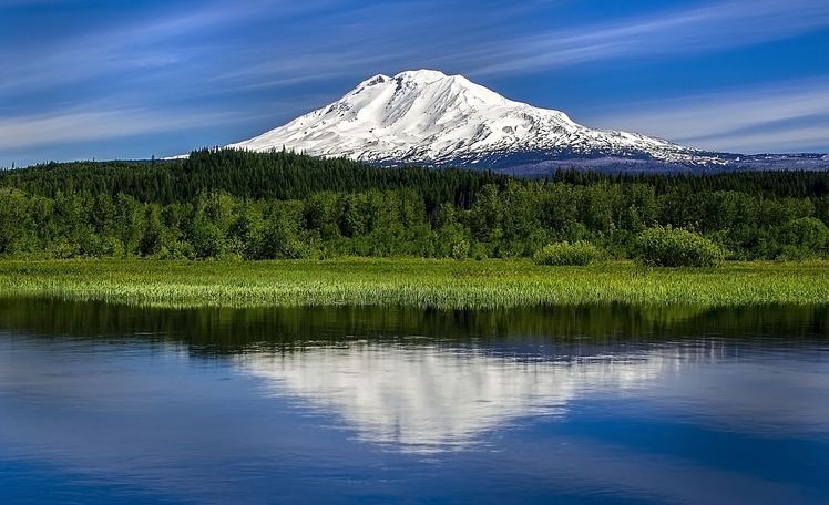
 Mount Adams
Weather Forecast, United StatesIssued: 10 pm Wed 24 Apr Local TimeUpdates in: hr min sUpdate imminent
Mount AdamsWeather Forecast, United States
Issued: 10 pm Wed 24 Apr Local Time
Updates in:
Update imminent hr min s

Issued: 10 pm Wed 24 Apr Local Time
Updates in:
Update imminent hr min s
Days 1–4 Weather SummaryA heavy fall of snow, heaviest during Thu night. Temperatures will be well below freezing (max -9°C on Wed night, min -13°C on Thu night). Winds decreasing (near gales from the WSW on Thu afternoon, calm by Fri night). | Days 5–7 Weather SummaryA moderate fall of snow, heaviest on Sun night. Extremely cold (max -11°C on Sat night, min -18°C on Sun night). Winds decreasing (gales from the W on Sun night, fresh winds from the SW by Tue afternoon). | Days 8–10 Weather SummaryA light covering of new snow mostly falling on Wed night. Temperatures will be well below freezing (max -9°C on Wed afternoon, min -17°C on Thu morning). Winds decreasing (severe gales from the SW on Wed night, light winds from the SSW by Fri morning). | Days 11–13 Weather SummaryA heavy fall of snow, heaviest during Sat night. Temperatures will be well below freezing (max -8°C on Sun night, min -16°C on Fri night). Winds increasing (light winds from the W on Fri night, extremely windy from the WSW by Mon afternoon). | |||||||||||||||||||||||||||||||||
Thursday 25 | Friday 26 | Saturday 27 | Sunday 28 | Monday 29 | Tuesday 30 | Wednesday 1 | Thursday 2 | Friday 3 | Saturday 4 | Sunday 5 | Mon 6 | |||||||||||||||||||||||||
night | AM | PM | night | AM | PM | night | AM | PM | night | AM | PM | night | AM | PM | night | AM | PM | night | AM | PM | night | AM | PM | night | AM | PM | night | AM | PM | night | AM | PM | night | AM | PM | |
clear | light snow | snow shwrs | snow shwrs | clear | clear | clear | light snow | snow shwrs | snow shwrs | cloudy | snow shwrs | snow shwrs | snow shwrs | snow shwrs | some clouds | some clouds | some clouds | some clouds | cloudy | light snow | snow shwrs | clear | snow shwrs | some clouds | some clouds | snow shwrs | snow shwrs | snow shwrs | light snow | snow shwrs | snow shwrs | snow shwrs | some clouds | snow shwrs | snow shwrs | |
km/h | ||||||||||||||||||||||||||||||||||||
Wave Height Map |  |  |  |  | 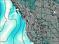 |  | 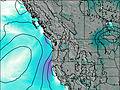 | 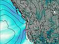 | 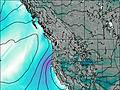 |  |  |  |  | |||||||||||||||||||||||
— | 2.0 | 6 | 9 | — | — | — | 2.0 | 1.0 | 3 | — | 1.0 | 7 | 1.0 | 1.0 | — | — | — | — | — | 2.0 | 4 | — | 2.0 | — | — | 1.0 | 4 | 1.0 | 1.0 | 20 | 2.0 | 2.0 | — | 5 | 12 | |
— | — | — | — | — | — | — | — | — | — | — | — | — | — | — | — | — | — | — | — | — | — | — | — | — | — | — | — | — | — | — | — | — | — | — | — | |
max°C | -9 | -10 | -11 | -12 | -13 | -13 | -12 | -12 | -12 | -11 | -11 | -12 | -15 | -16 | -16 | -15 | -14 | -13 | -10 | -10 | -9 | -14 | -16 | -15 | -15 | -16 | -16 | -16 | -14 | -14 | -14 | -13 | -11 | -8 | -9 | -12 |
min°C | -10 | -10 | -11 | -13 | -13 | -13 | -12 | -12 | -12 | -11 | -12 | -14 | -18 | -18 | -16 | -17 | -15 | -13 | -12 | -10 | -10 | -16 | -17 | -16 | -15 | -16 | -16 | -16 | -15 | -14 | -14 | -13 | -13 | -9 | -11 | -14 |
-21 | -20 | -24 | -24 | -22 | -19 | -16 | -22 | -22 | -23 | -24 | -27 | -35 | -34 | -30 | -31 | -28 | -24 | -24 | -22 | -22 | -31 | -29 | -27 | -27 | -26 | -25 | -24 | -28 | -25 | -29 | -28 | -27 | -22 | -26 | -31 | |
1950 | 1900 | 1700 | 1650 | 1700 | 1800 | 1600 | 1550 | 1650 | 1450 | 1600 | 1600 | 1100 | 1150 | 1450 | 750 | 1700 | 2000 | 1800 | 2300 | 1750 | 1050 | 1550 | 1750 | 1050 | 1400 | 1550 | 1250 | 1300 | 1650 | 1350 | 1400 | 1550 | 1350 | 1550 | 1400 | |
Cloud base (m) | 900 | 1450 | 1450 | 1450 | 1450 | 1500 | 1450 | 950 | 900 | 950 | 950 | 1500 | 950 | 950 | 1500 | 1850 | 1650 | 1800 | 2950 | 2600 | 2000 | 1450 | 1500 | 1700 | 1450 | 1500 | 1550 | 1450 | 1450 | 1500 | 1450 | 1500 | 1450 | 1700 | 1450 | 1450 |
— | 6:00 | — | — | 5:58 | — | — | 5:56 | — | — | 5:56 | — | — | 5:54 | — | — | 5:52 | — | — | 5:50 | — | — | 5:48 | — | — | 5:48 | — | — | 5:46 | — | — | 5:45 | — | — | 5:43 | — | |
— | — | — | 8:07 | — | — | 8:07 | — | — | 8:09 | — | — | 8:10 | — | — | 8:12 | — | — | 8:14 | — | — | 8:15 | — | — | 8:15 | — | — | 8:16 | — | — | 8:19 | — | — | 8:20 | — | 8:21 | |
Mount Adams Weather (Days 0-3):
The weather forecast for Mount Adams is: A heavy fall of snow, heaviest during Thu night. Temperatures will be well below freezing (max -9°C on Wed night, min -13°C on Thu night). Winds decreasing (near gales from the WSW on Thu afternoon, calm by Fri night).
Mount Adams Weather (Days 3-6):
A moderate fall of snow, heaviest on Sun night. Extremely cold (max -11°C on Sat night, min -18°C on Sun night). Winds decreasing (gales from the W on Sun night, fresh winds from the SW by Tue afternoon).
Mount Adams Weather (Days 6-9):
A light covering of new snow mostly falling on Wed night. Temperatures will be well below freezing (max -9°C on Wed afternoon, min -17°C on Thu morning). Winds decreasing (severe gales from the SW on Wed night, light winds from the SSW by Fri morning).
This table gives the weather forecast for Mount Adams at the specific elevation of 3741 m. Our advanced weather models allow us to provide distinct weather forecasts for several elevations of Mount Adams. To see the weather forecasts for the other elevations, use the tab navigation above the table. For a wider overview of the weather, consult the Weather Map of Washington.
| Weather Station | Temp. | Weather | Wind | Gusts | Cloud / Visibility |
|---|---|---|---|---|---|
Ken Jernstedt Airfield - Hood River (Oregon) | |||||
The Dalles Airport | |||||
* NOTE: not all weather observatories update at the same frequency which is the reason why some locations may show data from stations that are further away than known closer ones.
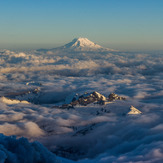
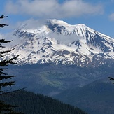
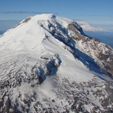
Mount Adams Photos
View all
Cascade Range photos (410) |
Pacific Coast Ranges photos (962) |
photos from mountains in United States (2751) |
all photos
 Upload new photo
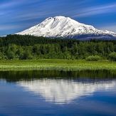
 See 15 more Mount Adams photos
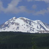
Mount Adams
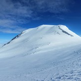
Mt. Adams and the Tatoosh Range
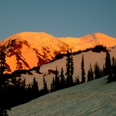
Glorious Mt. Adams
South Side Mt. Adams
Stratovolcano
Summit Block from Pikers Peak
Mount Adams north side
 Like us
 Follow us
