– Lat/Long: 44.50° N 123.55° W
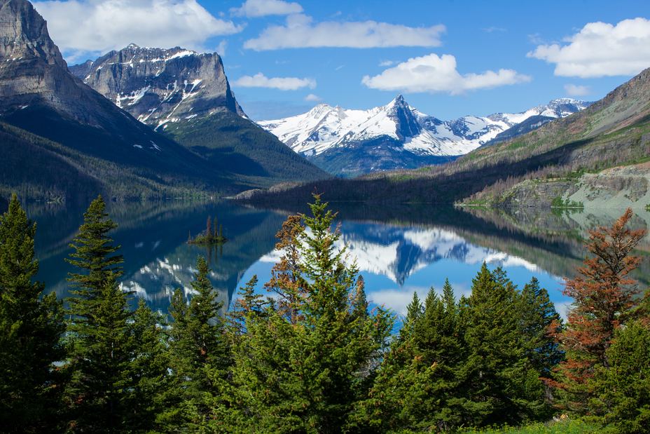
 Marys Peak
Weather Forecast, United StatesIssued: 10 am Tue 09 Jun Local TimeUpdates in: hr min sUpdate imminent
Issued: 10 am Tue 09 Jun Local Time
Updates in:
Update imminent hr min s

Issued: 10 am Tue 09 Jun Local Time
Updates in:
Update imminent hr min s
Days 1–3 Weather SummaryLight rain (total 3mm), mostly falling on Tue morning. Very mild (max 14°C on Thu afternoon, min 3°C on Tue night). Winds decreasing (fresh winds from the WSW on Tue morning, calm by Thu afternoon). | Days 4–6 Weather SummaryMostly dry. Warm (max 24°C on Sun afternoon, min 11°C on Fri morning). Winds decreasing (strong winds from the E on Sat night, light winds from the NE by Sun night). | |||||||||||||||||
Tuesday 9 | Wednesday 10 | Thursday 11 | Friday 12 | Saturday 13 | Sunday 14 | |||||||||||||
AM | PM | night | AM | PM | night | AM | PM | night | AM | PM | night | AM | PM | night | AM | PM | night | |
rain shwrs | rain shwrs | rain shwrs | clear | clear | clear | clear | clear | clear | clear | clear | clear | clear | clear | clear | clear | clear | clear | |
km/h | ||||||||||||||||||
 |  |  |  |  |  | |||||||||||||
— | — | — | — | — | — | — | — | — | — | — | — | — | — | — | — | — | — | |
2 | 0.7 | 0.1 | — | — | — | — | — | — | — | — | — | — | — | — | — | — | — | |
max °C | 4 | 4 | 4 | 5 | 8 | 9 | 13 | 14 | 13 | 13 | 15 | 15 | 15 | 19 | 19 | 21 | 24 | 23 |
min °C | 4 | 4 | 3 | 3 | 7 | 7 | 11 | 13 | 11 | 11 | 14 | 13 | 13 | 17 | 18 | 20 | 22 | 21 |
-1 | -1 | -1 | -1 | 4 | 5 | 9 | 12 | 10 | 10 | 14 | 11 | 11 | 16 | 17 | 20 | 22 | 21 | |
2150 | 2550 | 3050 | 3100 | 3400 | 3800 | 3700 | 3950 | 4050 | 4250 | 4350 | 4200 | 4350 | 4500 | 4650 | 4700 | 4750 | 4750 | |
Cloud base (m) | 500 | 800 | 1650 | 950 | 1850 | |||||||||||||
5:28 | — | — | 5:28 | — | — | 5:28 | — | — | 5:28 | — | — | 5:28 | — | — | 5:28 | — | — | |
— | — | 8:57 | — | — | 8:58 | — | — | 8:58 | — | — | 8:59 | — | — | 8:59 | — | — | 9:00 | |
Loading...
Marys Peak Weather (Days 0-3):
The weather forecast for Marys Peak is: Light rain (total 3mm), mostly falling on Tue morning. Very mild (max 14°C on Thu afternoon, min 3°C on Tue night). Winds decreasing (fresh winds from the WSW on Tue morning, calm by Thu afternoon).
Marys Peak Weather (Days 3-6):
Mostly dry. Warm (max 24°C on Sun afternoon, min 11°C on Fri morning). Winds decreasing (strong winds from the E on Sat night, light winds from the NE by Sun night).
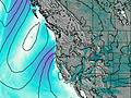
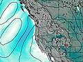
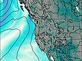
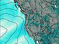
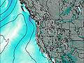
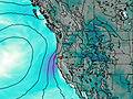
This table gives the weather forecast for Marys Peak at the specific elevation of 1249 m. Our advanced weather models allow us to provide distinct weather forecasts for several elevations of Marys Peak. To see the weather forecasts for the other elevations, use the tab navigation above the table. For a wider overview of the weather, consult the Weather Map of Oregon.
| Weather Station | Temp. | Weather | Wind | Gusts | Cloud / Visibility |
|---|---|---|---|---|---|
Newport Airport | |||||
BUOY-SBEO3 | |||||
BUOY-NWPO3 | |||||
Eugene Airport | |||||
BUOY-46283 | |||||
BUOY-46097 | |||||
Salem Airport | |||||
* NOTE: not all weather observatories update at the same frequency which is the reason why some locations may show data from stations that are further away than known closer ones.
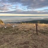
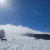
Marys Peak Photos
View all
Northwest U.S. Coast Ranges photos (12) |
Pacific Coast Ranges photos (1054) |
photos from mountains in United States (3050) |
all photos
 Upload new photo
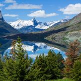
 See 12 more Marys Peak photos
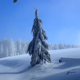
Marys Peak
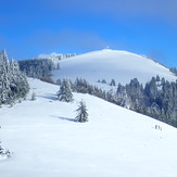
The upper meadow, Marys Peak
Marys Peak
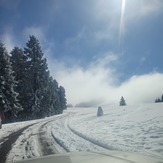
Snowy road
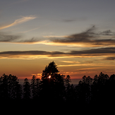
Sunset
Top of Marys Peak
Parking lot