– Lat/Long: 39.43° N 21.15° E
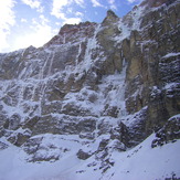
 Katafidhi
Weather Forecast, GreeceIssued: 8 am Tue 16 Apr Local TimeUpdates in: hr min sUpdate imminent
KatafidhiWeather Forecast, Greece
Issued: 8 am Tue 16 Apr Local Time
Updates in:
Update imminent hr min s

Issued: 8 am Tue 16 Apr Local Time
Updates in:
Update imminent hr min s
Days 1–3 Weather SummaryA dusting of new snow. Freeze-thaw conditions (max 8°C on Tue morning, min -4°C on Wed night). Winds increasing (light winds from the SW on Tue morning, near gales from the SW by Tue night). | Days 4–6 Weather SummaryA moderate fall of snow, heaviest on Fri night. Temperatures will be below freezing (max 0°C on Sun night, min -4°C on Fri night). Winds increasing (light winds from the W on Sat night, strong winds from the SW by Sun afternoon). | Days 7–9 Weather SummaryA dusting of new snow. Freeze-thaw conditions (max 3°C on Wed night, min -3°C on Tue morning). Winds decreasing (strong winds from the WSW on Mon afternoon, light winds from the NW by Tue night). | Days 10–12 Weather SummaryMostly dry. Mild temperatures (max 7°C on Sat night, min 2°C on Thu morning). Wind will be generally light. | |||||||||||||||||||||||||||||||||
Tuesday 16 | Wednesday 17 | Thursday 18 | Friday 19 | Saturday 20 | Sunday 21 | Monday 22 | Tuesday 23 | Wednesday 24 | Thursday 25 | Friday 26 | Saturday 27 | |||||||||||||||||||||||||
AM | PM | night | AM | PM | night | AM | PM | night | AM | PM | night | AM | PM | night | AM | PM | night | AM | PM | night | AM | PM | night | AM | PM | night | AM | PM | night | AM | PM | night | AM | PM | night | |
some clouds | some clouds | some clouds | some clouds | light snow | snow shwrs | clear | some clouds | cloudy | cloudy | mod. snow | snow shwrs | clear | some clouds | clear | some clouds | light snow | cloudy | cloudy | snow shwrs | clear | clear | clear | clear | clear | clear | clear | clear | clear | clear | clear | clear | clear | clear | clear | some clouds | |
km/h | ||||||||||||||||||||||||||||||||||||
Wave Height Map |  |  |  |  |  |  |  |  |  |  |  |  | ||||||||||||||||||||||||
— | — | — | — | 1.0 | 3 | — | — | — | — | 7 | 9 | — | — | — | — | 1.0 | — | — | 1.0 | — | — | — | — | — | — | — | — | — | — | — | — | — | — | — | — | |
— | — | — | — | — | — | — | — | — | — | — | — | — | — | — | — | — | — | — | — | — | — | — | — | — | — | — | — | — | — | — | — | — | — | — | — | |
max°C | 8 | 6 | 4 | 2 | 2 | 0 | -4 | -4 | -3 | -3 | -2 | -3 | -1 | -1 | -2 | -2 | -2 | 0 | -1 | 0 | 0 | -2 | 0 | 1 | 1 | 2 | 3 | 2 | 3 | 4 | 5 | 5 | 5 | 6 | 6 | 7 |
min°C | 7 | 5 | 3 | 2 | 1 | -4 | -4 | -4 | -4 | -3 | -2 | -4 | -2 | -2 | -3 | -3 | -2 | -1 | -1 | -1 | -2 | -3 | -1 | 0 | 0 | 2 | 2 | 2 | 3 | 3 | 4 | 5 | 5 | 5 | 6 | 6 |
4 | 0 | -4 | -4 | -6 | -14 | -14 | -13 | -13 | -10 | -10 | -11 | -9 | -7 | -8 | -10 | -10 | -8 | -8 | -9 | -8 | -8 | -5 | -5 | -5 | -3 | -3 | -3 | -1 | -2 | 0 | 2 | 3 | 1 | 2 | 2 | |
3500 | 3350 | 2900 | 2700 | 2650 | 2150 | 1750 | 2000 | 1850 | 1900 | 2050 | 1650 | 1900 | 2250 | 1900 | 1950 | 2100 | 2150 | 2250 | 2300 | 2300 | 2000 | 2250 | 2600 | 2400 | 2600 | 2950 | 2850 | 2900 | 3000 | 3150 | 3050 | 3100 | 3100 | 3100 | 3350 | |
Cloud base (m) | 5400 | 3400 | 2600 | 1850 | 1900 | 800 | 850 | 1800 | 800 | 800 | 1500 | 800 | 1500 | 2000 | 1650 | 2350 | 1800 | 800 | 1750 | 1750 | 8350 | 2600 | 900 | 9600 | 7850 | 8600 | 6200 | |||||||||
6:56 | — | — | 6:54 | — | — | 6:52 | — | — | 6:52 | — | — | 6:50 | — | — | 6:48 | — | — | 6:47 | — | — | 6:46 | — | — | 6:45 | — | — | 6:43 | — | — | 6:41 | — | — | 6:41 | — | — | |
— | 8:14 | — | — | 8:15 | — | — | 8:15 | — | — | 8:16 | — | — | 8:17 | — | — | 8:19 | — | — | 8:20 | — | — | 8:21 | — | — | 8:22 | — | — | 8:22 | — | — | 8:23 | — | — | 8:24 | — | |
Katafidhi Weather (Days 0-3):
The weather forecast for Katafidhi is: A dusting of new snow. Freeze-thaw conditions (max 8°C on Tue morning, min -4°C on Wed night). Winds increasing (light winds from the SW on Tue morning, near gales from the SW by Tue night).
Katafidhi Weather (Days 3-6):
A moderate fall of snow, heaviest on Fri night. Temperatures will be below freezing (max 0°C on Sun night, min -4°C on Fri night). Winds increasing (light winds from the W on Sat night, strong winds from the SW by Sun afternoon).
Katafidhi Weather (Days 6-9):
A dusting of new snow. Freeze-thaw conditions (max 3°C on Wed night, min -3°C on Tue morning). Winds decreasing (strong winds from the WSW on Mon afternoon, light winds from the NW by Tue night).
This table gives the weather forecast for Katafidhi at the specific elevation of 2393 m. Our advanced weather models allow us to provide distinct weather forecasts for several elevations of Katafidhi. To see the weather forecasts for the other elevations, use the tab navigation above the table. For a wider overview of the weather, consult the Weather Map of Greece.
* NOTE: not all weather observatories update at the same frequency which is the reason why some locations may show data from stations that are further away than known closer ones.
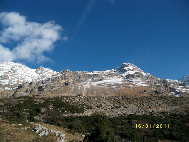
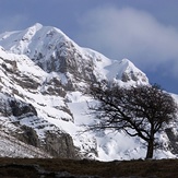
Katafidhi Photos
View all
Pindos photos (113) |
Balkan Peninsula photos (1006) |
photos from mountains in Greece (656) |
all photos
 Upload new photo
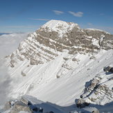

Katafidhi
Katafidhi
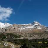
tzumerka katafidi 2393m
Τζουμέρκα
tzumerka katafidi 2393m
 Like us
 Follow us
