– Lat/Long: 61.95° N 9.90° E
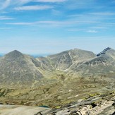
 Høgronden (Hogronden)
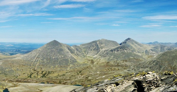
Weather Forecast, NorwayIssued: 1 pm Tue 09 Jun Local TimeUpdates in: hr min sUpdate imminent
Issued: 1 pm Tue 09 Jun Local Time
Updates in:
Update imminent hr min s

Issued: 1 pm Tue 09 Jun Local Time
Updates in:
Update imminent hr min s
Days 1–4 Weather SummaryLight rain (total 9mm) on Tue night. Becoming colder with heavy fall of snow, heaviest during Wed morning. Freeze-thaw conditions (max 3°C on Tue afternoon, min -4°C on Wed afternoon). Mainly strong winds. | Days 5–7 Weather SummaryA light covering of new snow mostly falling on Sat afternoon. Freeze-thaw conditions (max 2°C on Fri night, min -4°C on Mon morning). Mainly fresh winds. | ||||||||||||||||
Tue 9 | Wednesday 10 | Thursday 11 | Friday 12 | Saturday 13 | Sunday 14 | ||||||||||||
PM | night | AM | PM | night | AM | PM | night | AM | PM | night | AM | PM | night | AM | PM | night | |
light snow | light snow | heavy snow | light snow | cloudy | clear | some clouds | snow shwrs | cloudy | cloudy | some clouds | cloudy | light snow | light snow | some clouds | snow shwrs | some clouds | |
km/h | |||||||||||||||||
 |  |  |  |  |  | ||||||||||||
1 | 5 | 12 | 5 | — | — | — | 2 | — | — | — | — | 2 | 1 | — | 2 | — | |
1.5 | 8 | — | — | — | — | — | — | — | — | — | — | — | — | — | — | — | |
max °C | 3 | 2 | -1 | -4 | -3 | -2 | 0 | 0 | -1 | 1 | 2 | 0 | -1 | -1 | -1 | 0 | -1 |
min °C | 2 | -1 | -3 | -4 | -3 | -3 | -1 | -2 | -2 | 0 | 0 | -1 | -1 | -3 | -2 | 0 | -3 |
-5 | -4 | -9 | -10 | -10 | -8 | -6 | -5 | -6 | -5 | -2 | -1 | -1 | -6 | -7 | -5 | -8 | |
2550 | 2200 | 1300 | 1500 | 1650 | 1750 | 2150 | 2000 | 2000 | 2250 | 2250 | 2150 | 2000 | 1650 | 2000 | 2050 | 1750 | |
Cloud base (m) | 700 | 650 | 700 | 700 | 800 | 800 | 2400 | 2450 | 2250 | 2350 | 2350 | 1950 | 750 | 800 | 1750 | 1950 | 850 |
— | — | 3:35 | — | — | 3:33 | — | — | 3:33 | — | — | 3:32 | — | — | 3:31 | — | — | |
— | 11:02 | — | — | 11:04 | — | — | 11:05 | — | — | 11:07 | — | — | 11:07 | — | — | 11:08 | |
Loading...
Høgronden Weather (Days 0-3):
The weather forecast for Høgronden is: Light rain (total 9mm) on Tue night. Becoming colder with heavy fall of snow, heaviest during Wed morning. Freeze-thaw conditions (max 3°C on Tue afternoon, min -4°C on Wed afternoon). Mainly strong winds.
Høgronden Weather (Days 3-6):
A light covering of new snow mostly falling on Sat afternoon. Freeze-thaw conditions (max 2°C on Fri night, min -4°C on Mon morning). Mainly fresh winds.
This table gives the weather forecast for Høgronden at the specific elevation of 2114 m. Our advanced weather models allow us to provide distinct weather forecasts for several elevations of Høgronden. To see the weather forecasts for the other elevations, use the tab navigation above the table. For a wider overview of the weather, consult the Weather Map of Norway.