– Lat/Long: 46.83° N 11.08° E
 Hochfirst (Ötztal Alps) (Hochfirst (Otztal Alps))
Weather Forecast, ItalyIssued: 1 pm Tue 09 Jun Local TimeUpdates in: hr min sUpdate imminent
Issued: 1 pm Tue 09 Jun Local Time
Updates in:
Update imminent hr min s

Issued: 1 pm Tue 09 Jun Local Time
Updates in:
Update imminent hr min s
Days 1–4 Weather SummaryA heavy fall of snow, heaviest during Tue night. Freeze-thaw conditions (max 1°C on Tue afternoon, min -6°C on Wed night). Wind will be generally light. | Days 5–7 Weather SummaryA dusting of new snow. Freeze-thaw conditions (max 2°C on Sun afternoon, min -3°C on Fri afternoon). Wind will be generally light. | ||||||||||||||||
Tue 9 | Wednesday 10 | Thursday 11 | Friday 12 | Saturday 13 | Sunday 14 | ||||||||||||
PM | night | AM | PM | night | AM | PM | night | AM | PM | night | AM | PM | night | AM | PM | night | |
snow shwrs | heavy snow | heavy snow | heavy snow | snow shwrs | clear | clear | some clouds | light snow | snow shwrs | snow shwrs | clear | some clouds | clear | clear | rain shwrs | clear | |
km/h | |||||||||||||||||
 |  |  |  |  |  | ||||||||||||
3 | 17 | 11 | 13 | 5 | — | — | — | 1 | 1 | 1 | — | — | — | — | — | — | |
— | — | — | — | — | — | — | — | — | — | — | — | — | — | — | 0.1 | — | |
max °C | 1 | 0 | -3 | -4 | -5 | -6 | -5 | -5 | -4 | -2 | -2 | -2 | 0 | 1 | 1 | 2 | 1 |
min °C | 1 | -3 | -4 | -5 | -6 | -6 | -5 | -5 | -4 | -3 | -3 | -2 | 0 | 0 | 0 | 2 | 1 |
-2 | -5 | -8 | -9 | -12 | -10 | -11 | -11 | -10 | -9 | -9 | -7 | -4 | -4 | -4 | -1 | -3 | |
3500 | 3250 | 2700 | 2600 | 2200 | 2500 | 2750 | 2450 | 2800 | 3000 | 2800 | 3050 | 3450 | 3450 | 3450 | 3700 | 3600 | |
Cloud base (m) | 2500 | 2300 | 2250 | 2250 | 2450 | 2750 | 2700 | 2700 | 2550 | 2600 | 2400 | 2900 | 3350 | 9500 | |||
— | — | 5:20 | — | — | 5:20 | — | — | 5:20 | — | — | 5:20 | — | — | 5:20 | — | — | |
— | 9:07 | — | — | 9:07 | — | — | 9:08 | — | — | 9:08 | — | — | 9:09 | — | — | 9:09 | |
Loading...
Hochfirst (Ötztal Alps) Weather (Days 0-3):
The weather forecast for Hochfirst (Ötztal Alps) is: A heavy fall of snow, heaviest during Tue night. Freeze-thaw conditions (max 1°C on Tue afternoon, min -6°C on Wed night). Wind will be generally light.
Hochfirst (Ötztal Alps) Weather (Days 3-6):
A dusting of new snow. Freeze-thaw conditions (max 2°C on Sun afternoon, min -3°C on Fri afternoon). Wind will be generally light.
This table gives the weather forecast for Hochfirst (Ötztal Alps) at the specific elevation of 3405 m. Our advanced weather models allow us to provide distinct weather forecasts for several elevations of Hochfirst (Ötztal Alps). To see the weather forecasts for the other elevations, use the tab navigation above the table. For a wider overview of the weather, consult the Weather Map of Italy.
| Weather Station | Temp. | Weather | Wind | Gusts | Cloud / Visibility |
|---|---|---|---|---|---|
lightning 4km ENE of San Leonardo in Passiria | |||||
Hinterer Brunnenkogel (Ötztaler Alpen) | |||||
lightning 8km N of Lasa | |||||
lightning 6km NNW of Silandro | |||||
lightning 9km NNE of Sluderno | |||||
Jochdohlen SP | |||||
Jochdohlen LP |
* NOTE: not all weather observatories update at the same frequency which is the reason why some locations may show data from stations that are further away than known closer ones.
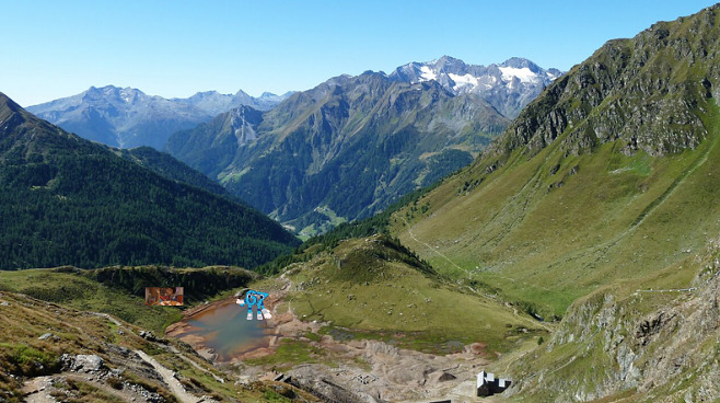
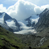
Hochfirst (Ötztal Alps) Photos
View all
Otztal Alps photos (77) |
Alps photos (1484) |
photos from mountains in Italy (430) |
all photos
 Upload new photo
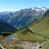
meme mountain
Hochfirst (Ötztal Alps)