– Lat/Long: 36.10° N 82.08° W
 Grassy Ridge Bald
Weather Forecast, United StatesIssued: 1 am Tue 09 Jun Local TimeUpdates in: hr min sUpdate imminent
Issued: 1 am Tue 09 Jun Local Time
Updates in:
Update imminent hr min s

Issued: 1 am Tue 09 Jun Local Time
Updates in:
Update imminent hr min s
Days 1–3 Weather SummaryHeavy rain (total 27mm), heaviest during Wed night. Very mild (max 19°C on Thu afternoon, min 14°C on Tue morning). Wind will be generally light. | Days 4–6 Weather SummaryLight rain (total 8mm), mostly falling on Sun night. Very mild (max 19°C on Fri afternoon, min 14°C on Sun night). Winds decreasing (fresh winds from the NW on Fri night, light winds from the E by Sat night). | |||||||||||||||||
Tuesday 9 | Wednesday 10 | Thursday 11 | Friday 12 | Saturday 13 | Sunday 14 | |||||||||||||
AM | PM | night | AM | PM | night | AM | PM | night | AM | PM | night | AM | PM | night | AM | PM | night | |
rain shwrs | risk tstorm | rain shwrs | some clouds | risk tstorm | rain shwrs | risk tstorm | rain shwrs | risk tstorm | risk tstorm | clear | risk tstorm | risk tstorm | clear | some clouds | some clouds | some clouds | light rain | |
km/h | ||||||||||||||||||
 |  |  |  |  |  | |||||||||||||
— | — | — | — | — | — | — | — | — | — | — | — | — | — | — | — | — | — | |
1.9 | 3 | 4 | — | 5 | 5 | 0.8 | 1.6 | 6 | 1.8 | — | 3 | 0.6 | — | — | — | — | 3 | |
max °C | 15 | 14 | 15 | 16 | 17 | 17 | 17 | 19 | 18 | 17 | 19 | 18 | 15 | 19 | 18 | 17 | 16 | 15 |
min °C | 14 | 14 | 15 | 15 | 16 | 17 | 17 | 19 | 17 | 16 | 19 | 16 | 15 | 18 | 16 | 16 | 16 | 14 |
13 | 13 | 14 | 14 | 16 | 17 | 17 | 19 | 16 | 14 | 19 | 15 | 14 | 18 | 15 | 15 | 15 | 12 | |
4500 | 4550 | 4650 | 4650 | 4700 | 4700 | 4650 | 4650 | 4700 | 4700 | 4500 | 4850 | 4800 | 4700 | 4650 | 4650 | 4550 | 4550 | |
Cloud base (m) | 750 | 800 | 4150 | 2000 | 1600 | 5600 | 2400 | 8450 | 6400 | 2800 | 6700 | 6850 | 3750 | 900 | ||||
6:09 | — | — | 6:09 | — | — | 6:09 | — | — | 6:09 | — | — | 6:09 | — | — | 6:09 | — | — | |
— | — | 8:44 | — | — | 8:44 | — | — | 8:45 | — | — | 8:45 | — | — | 8:45 | — | — | 8:45 | |
Loading...
Grassy Ridge Bald Weather (Days 0-3):
The weather forecast for Grassy Ridge Bald is: Heavy rain (total 27mm), heaviest during Wed night. Very mild (max 19°C on Thu afternoon, min 14°C on Tue morning). Wind will be generally light.
Grassy Ridge Bald Weather (Days 3-6):
Light rain (total 8mm), mostly falling on Sun night. Very mild (max 19°C on Fri afternoon, min 14°C on Sun night). Winds decreasing (fresh winds from the NW on Fri night, light winds from the E by Sat night).
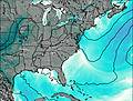
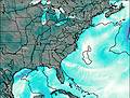
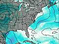
This table gives the weather forecast for Grassy Ridge Bald at the specific elevation of 1844 m. Our advanced weather models allow us to provide distinct weather forecasts for several elevations of Grassy Ridge Bald. To see the weather forecasts for the other elevations, use the tab navigation above the table. For a wider overview of the weather, consult the Weather Map of North-Carolina.
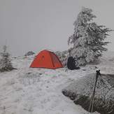
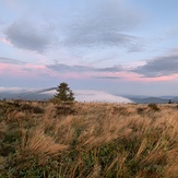
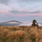
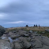
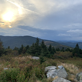
Grassy Ridge Bald Photos
View all
Blue Ridge Mountains photos (162) |
Appalachians photos (907) |
photos from mountains in United States (3050) |
all photos
 Upload new photo

 See 8 more Grassy Ridge Bald photos
Grassy ridge
Grassy ridge
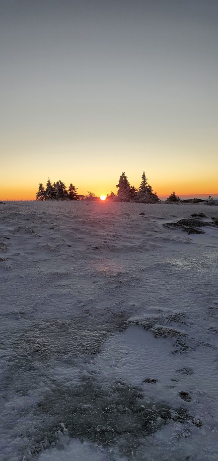
Soothing Sunset
Fall at GR
Fall at GR
Fall at GR
Fall at GR