– Lat/Long: 29.13° N 103.33° E
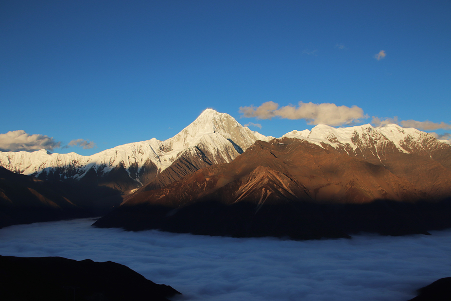
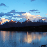
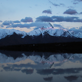
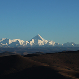
 Gongga Shan
Weather Forecast, ChinaIssued: 1 pm Tue 09 Jun Local TimeUpdates in: hr min sUpdate imminent
Issued: 1 pm Tue 09 Jun Local Time
Updates in:
Update imminent hr min s

Issued: 1 pm Tue 09 Jun Local Time
Updates in:
Update imminent hr min s
Days 1–4 Weather SummaryA dusting of new snow. Extremely cold (max -11°C on Tue night, min -12°C on Tue afternoon). Winds increasing (moderate winds from the W on Tue afternoon, near gales from the W by Thu night). | Days 5–7 Weather SummaryA dusting of new snow. Extremely cold (max -11°C on Sun afternoon, min -14°C on Fri night). Mainly strong winds. | ||||||||||||||||
Tue 9 | Wednesday 10 | Thursday 11 | Friday 12 | Saturday 13 | Sunday 14 | ||||||||||||
PM | night | AM | PM | night | AM | PM | night | AM | PM | night | AM | PM | night | AM | PM | night | |
some clouds | cloudy | some clouds | some clouds | some clouds | some clouds | snow shwrs | clear | snow shwrs | some clouds | cloudy | snow shwrs | some clouds | clear | clear | clear | snow shwrs | |
km/h | |||||||||||||||||
 |  |  |  |  |  | ||||||||||||
— | — | — | — | — | — | 1 | — | 1 | — | — | 2 | — | — | — | — | 2 | |
— | — | — | — | — | — | — | — | — | — | — | — | — | — | — | — | — | |
max °C | -12 | -11 | -11 | -11 | -11 | -11 | -11 | -11 | -12 | -12 | -13 | -13 | -13 | -13 | -12 | -11 | -12 |
min °C | -12 | -12 | -11 | -11 | -12 | -12 | -12 | -11 | -12 | -12 | -14 | -13 | -14 | -14 | -13 | -12 | -13 |
-21 | -23 | -23 | -23 | -24 | -23 | -24 | -23 | -25 | -24 | -24 | -23 | -24 | -23 | -24 | -22 | -24 | |
4850 | 4850 | 4800 | 4800 | 4800 | 4700 | 4800 | 4800 | 4750 | 5000 | 5000 | 5150 | 5250 | 5250 | 5200 | 5300 | 5000 | |
Cloud base (m) | 5150 | 4550 | 4500 | 3350 | 4900 | 4300 | 2550 | 3000 | 3100 | 2350 | 4200 | 6050 | 6300 | 5600 | |||
— | — | 6:07 | — | — | 6:07 | — | — | 6:07 | — | — | 6:07 | — | — | 6:07 | — | — | |
— | 8:04 | — | — | 8:05 | — | — | 8:05 | — | — | 8:05 | — | — | 8:06 | — | — | 8:06 | |
Loading...
Gongga Shan Weather (Days 0-3):
The weather forecast for Gongga Shan is: A dusting of new snow. Extremely cold (max -11°C on Tue night, min -12°C on Tue afternoon). Winds increasing (moderate winds from the W on Tue afternoon, near gales from the W by Thu night).
Gongga Shan Weather (Days 3-6):
A dusting of new snow. Extremely cold (max -11°C on Sun afternoon, min -14°C on Fri night). Mainly strong winds.
This table gives the weather forecast for Gongga Shan at the specific elevation of 7596 m. Our advanced weather models allow us to provide distinct weather forecasts for several elevations of Gongga Shan. To see the weather forecasts for the other elevations, use the tab navigation above the table. For a wider overview of the weather, consult the Weather Map of China.
| Weather Station | Temp. | Weather | Wind | Gusts | Cloud / Visibility |
|---|---|---|---|---|---|
lightning 245km NNW of Dayan | |||||
* NOTE: not all weather observatories update at the same frequency which is the reason why some locations may show data from stations that are further away than known closer ones.
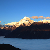
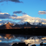
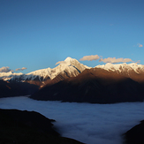
Gongga Shan Photos
View all
West Sichuan Ranges photos (29) |
Tibet and Central China photos (61) |
photos from mountains in China (98) |
all photos
 Upload new photo
Zimei Mountain pass
Zimei Mountain pass
Lenggacuo
Zimei Mountain pass
Lenggacuo
Lenggacuo
in Balangshengdu viewing platform