
– Lat/Long: 51.35° N 116.28° W
 Glacier Peak (Canadian Rockies)
Weather Forecast, CanadaIssued: 11 pm Wed 17 Apr Local TimeUpdates in: hr min sUpdate imminent
Glacier Peak (Canadian Rockies)Weather Forecast, Canada
Issued: 11 pm Wed 17 Apr Local Time
Updates in:
Update imminent hr min s

Issued: 11 pm Wed 17 Apr Local Time
Updates in:
Update imminent hr min s
Days 1–4 Weather SummaryA dusting of new snow. Freeze-thaw conditions (max 1°C on Sat afternoon, min -12°C on Wed night). Wind will be generally light. | Days 5–7 Weather SummaryA dusting of snow on Sun morning. Freezing level rising with drizzle on Mon afternoon. Freeze-thaw conditions (max 5°C on Tue afternoon, min -3°C on Sun morning). Wind will be generally light. | ||||||||||||||||||
Thursday 18 | Friday 19 | Saturday 20 | Sunday 21 | Monday 22 | Tuesday 23 | ||||||||||||||
night | AM | PM | night | AM | PM | night | AM | PM | night | AM | PM | night | AM | PM | night | AM | PM | night | |
snow shwrs | some clouds | cloudy | some clouds | some clouds | cloudy | clear | clear | clear | some clouds | light snow | cloudy | snow shwrs | some clouds | rain shwrs | some clouds | rain shwrs | rain shwrs | some clouds | |
km/h | |||||||||||||||||||
Wave Height Map |  | 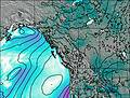 | 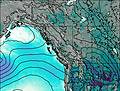 | 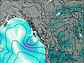 | 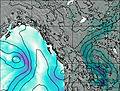 | 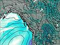 | 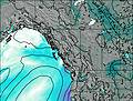 | ||||||||||||
1.0 | — | — | — | — | — | — | — | — | — | 1.0 | — | 2.0 | — | — | — | — | — | — | |
— | — | — | — | — | — | — | — | — | — | — | — | — | — | 0.8 | — | 0.1 | 0.2 | — | |
max°C | -7 | -7 | -5 | -7 | -6 | -2 | -4 | -1 | 1 | -1 | -2 | 0 | -1 | 1 | 3 | 2 | 2 | 5 | 3 |
min°C | -12 | -9 | -6 | -10 | -8 | -4 | -6 | -4 | 1 | -2 | -3 | -1 | -3 | -1 | 2 | -1 | 0 | 4 | 1 |
-16 | -12 | -10 | -10 | -8 | -4 | -6 | -6 | -2 | -4 | -6 | -4 | -7 | -4 | 1 | -3 | -2 | 2 | 1 | |
550 | 600 | 1300 | 700 | 800 | 1600 | 1300 | 1300 | 2100 | 1750 | 1600 | 1950 | 1850 | 1900 | 2300 | 2000 | 2050 | 2500 | 2300 | |
Cloud base (m) | 2400 | 3800 | 3000 | 3000 | 2200 | 2700 | 2900 | 2750 | 2950 | 2350 | 2200 | 2200 | 2550 | 2750 | 2700 | 2200 | 2750 | 2850 | |
— | 6:41 | — | — | 6:39 | — | — | 6:37 | — | — | 6:35 | — | — | 6:33 | — | — | 6:31 | — | — | |
— | — | 8:46 | — | — | 8:49 | — | — | 8:51 | — | — | 8:52 | — | — | 8:53 | — | — | 8:55 | — | |
Glacier Peak (Canadian Rockies) Weather (Days 0-3):
The weather forecast for Glacier Peak (Canadian Rockies) is: A dusting of new snow. Freeze-thaw conditions (max 1°C on Sat afternoon, min -12°C on Wed night). Wind will be generally light.
Glacier Peak (Canadian Rockies) Weather (Days 3-6):
A dusting of snow on Sun morning. Freezing level rising with drizzle on Mon afternoon. Freeze-thaw conditions (max 5°C on Tue afternoon, min -3°C on Sun morning). Wind will be generally light.
This table gives the weather forecast for Glacier Peak (Canadian Rockies) at the specific elevation of 2000 m. Our advanced weather models allow us to provide distinct weather forecasts for several elevations of Glacier Peak (Canadian Rockies). To see the weather forecasts for the other elevations, use the tab navigation above the table. For a wider overview of the weather, consult the Weather Map of British-Columbia.
 Like us
 Follow us
