
– Lat/Long: 45.37° N 111.36° W
 Gallatin Peak
Weather Forecast, United StatesIssued: 5 am Wed 24 Apr Local TimeUpdates in: hr min sUpdate imminent
Gallatin PeakWeather Forecast, United States
Issued: 5 am Wed 24 Apr Local Time
Updates in:
Update imminent hr min s

Issued: 5 am Wed 24 Apr Local Time
Updates in:
Update imminent hr min s
Days 1–3 Weather SummaryMild at first with light rain (total 10mm) on Thu afternoon followed by colder weather and light fall of snow, heaviest on Thu night. Freeze-thaw conditions (max 8°C on Wed afternoon, min -2°C on Fri night). Wind will be generally light. | Days 4–6 Weather SummaryA light covering of new snow mostly falling on Sat morning. Becoming milder with light rain (total 2mm) on Mon afternoon. Freeze-thaw conditions (max 2°C on Sun afternoon, min -2°C on Sat morning). Winds increasing (calm on Sat night, fresh winds from the WSW by Mon night). | |||||||||||||||||
Wednesday 24 | Thursday 25 | Friday 26 | Saturday 27 | Sunday 28 | Monday 29 | |||||||||||||
AM | PM | night | AM | PM | night | AM | PM | night | AM | PM | night | AM | PM | night | AM | PM | night | |
clear | some clouds | rain shwrs | rain shwrs | rain shwrs | heavy snow | light snow | light snow | cloudy | light snow | light snow | cloudy | some clouds | some clouds | snow shwrs | some clouds | light snow | light snow | |
km/h | ||||||||||||||||||
Wave Height Map | 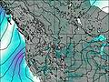 | 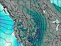 | 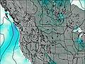 | 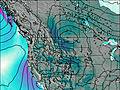 | 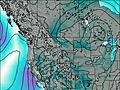 | 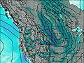 | ||||||||||||
— | — | — | — | — | 15 | 3 | 1.0 | — | 4 | 1.0 | — | — | — | 1.0 | — | 1.0 | 1.0 | |
— | — | 0.5 | 1.9 | 5 | 2 | — | — | — | — | — | — | — | — | — | — | 2 | — | |
max°C | 7 | 8 | 5 | 3 | 4 | 2 | 0 | 0 | 0 | -1 | -1 | -1 | 0 | 2 | 1 | 2 | 2 | 0 |
min°C | 5 | 8 | 2 | 3 | 4 | -1 | -1 | 0 | -2 | -2 | -1 | -2 | -2 | 2 | -1 | 0 | 2 | -2 |
2 | 6 | 0 | 1 | 2 | -3 | -1 | -2 | -5 | -5 | -4 | -4 | -5 | -2 | -7 | -6 | -3 | -8 | |
3250 | 3500 | 3300 | 2900 | 3000 | 2700 | 2400 | 2500 | 2350 | 2250 | 2350 | 2300 | 2300 | 2750 | 2600 | 2550 | 2750 | 2300 | |
Cloud base (m) | 6900 | 5750 | 4800 | 2600 | 2800 | 2500 | 2450 | 2450 | 2450 | 2450 | 2450 | 2450 | 2450 | 2700 | 2550 | 2450 | 2650 | 2550 |
6:22 | — | — | 6:22 | — | — | 6:20 | — | — | 6:18 | — | — | 6:16 | — | — | 6:15 | — | — | |
— | 8:22 | — | — | 8:24 | — | — | 8:25 | — | — | 8:27 | — | — | 8:29 | — | — | 8:30 | — | |
Gallatin Peak Weather (Days 0-3):
The weather forecast for Gallatin Peak is: Mild at first with light rain (total 10mm) on Thu afternoon followed by colder weather and light fall of snow, heaviest on Thu night. Freeze-thaw conditions (max 8°C on Wed afternoon, min -2°C on Fri night). Wind will be generally light.
Gallatin Peak Weather (Days 3-6):
A light covering of new snow mostly falling on Sat morning. Becoming milder with light rain (total 2mm) on Mon afternoon. Freeze-thaw conditions (max 2°C on Sun afternoon, min -2°C on Sat morning). Winds increasing (calm on Sat night, fresh winds from the WSW by Mon night).
This table gives the weather forecast for Gallatin Peak at the specific elevation of 2500 m. Our advanced weather models allow us to provide distinct weather forecasts for several elevations of Gallatin Peak. To see the weather forecasts for the other elevations, use the tab navigation above the table. For a wider overview of the weather, consult the Weather Map of Montana.
 Like us
 Follow us
