
– Lat/Long: 42.27° S 145.83° E
 Frenchman's Cap
Weather Forecast, AustraliaIssued: 3 pm Thu 25 Apr Local TimeUpdates in: hr min sUpdate imminent
Frenchman's CapWeather Forecast, Australia
Issued: 3 pm Thu 25 Apr Local Time
Updates in:
Update imminent hr min s

Issued: 3 pm Thu 25 Apr Local Time
Updates in:
Update imminent hr min s
Days 1–4 Weather SummaryMostly dry. Freeze-thaw conditions (max 4°C on Fri night, min 0°C on Thu afternoon). Winds increasing (light winds from the WNW on Fri night, strong winds from the NW by Sun morning). | Days 5–7 Weather SummaryMild at first with light rain (total 5mm) on Sun night followed by colder weather and light fall of snow, heaviest on Mon night. Freeze-thaw conditions (max 5°C on Sun afternoon, min -4°C on Wed morning). Winds decreasing (stormy winds from the NNW on Sun night, light winds from the WSW by Tue night). | Days 8–10 Weather SummaryA dusting of snow on Thu morning. Freezing level rising with drizzle on Thu night. Freeze-thaw conditions (max 6°C on Fri night, min -2°C on Wed afternoon). Winds decreasing (gales from the SE on Thu night, moderate winds from the ENE by Sat morning). | Days 11–13 Weather SummaryLight rain (total 6mm), mostly falling on Mon night. Freeze-thaw conditions (max 6°C on Sat afternoon, min -2°C on Tue afternoon). Winds increasing (light winds from the NW on Sat afternoon, near gales from the W by Mon night). | |||||||||||||||||||||||||||||||||
Thu 25 | Friday 26 | Saturday 27 | Sunday 28 | Monday 29 | Tuesday 30 | Wednesday 1 | Thursday 2 | Friday 3 | Saturday 4 | Sunday 5 | Monday 6 | Tue 7 | ||||||||||||||||||||||||
PM | night | AM | PM | night | AM | PM | night | AM | PM | night | AM | PM | night | AM | PM | night | AM | PM | night | AM | PM | night | AM | PM | night | AM | PM | night | AM | PM | night | AM | PM | night | AM | |
cloudy | cloudy | cloudy | rain shwrs | some clouds | some clouds | rain shwrs | some clouds | clear | some clouds | rain shwrs | snow shwrs | snow shwrs | snow shwrs | some clouds | snow shwrs | some clouds | some clouds | cloudy | cloudy | light snow | cloudy | light rain | light rain | some clouds | clear | clear | clear | clear | clear | light rain | some clouds | some clouds | rain shwrs | mod. rain | some clouds | |
km/h | ||||||||||||||||||||||||||||||||||||
Wave Height Map |  | 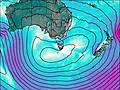 | 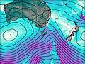 | 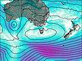 | 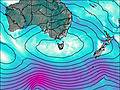 | 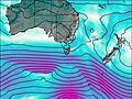 | 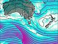 | 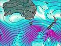 | 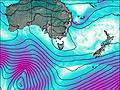 |  |  |  |  | |||||||||||||||||||||||
— | — | — | — | — | — | — | — | — | — | — | 4 | 2.0 | 8 | — | 1.0 | — | — | — | — | 2.0 | — | — | — | — | — | — | — | — | — | — | — | — | — | — | — | |
— | — | — | 0.3 | — | — | 0.4 | — | — | — | 5 | — | — | — | — | — | — | — | — | — | — | — | 0.9 | 0.1 | — | — | — | — | — | — | 0.4 | — | — | 0.1 | 5 | — | |
max°C | 1 | 2 | 2 | 2 | 4 | 3 | 3 | 2 | 3 | 5 | 5 | 1 | -2 | -2 | -2 | -2 | -3 | -2 | -2 | -2 | -2 | 1 | 4 | 3 | 3 | 6 | 6 | 6 | 5 | 5 | 3 | 3 | 3 | 2 | 4 | 0 |
min°C | 0 | 1 | 1 | 2 | 2 | 3 | 2 | 1 | 2 | 4 | 2 | -1 | -2 | -3 | -3 | -3 | -3 | -4 | -2 | -2 | -2 | -1 | 3 | 3 | 2 | 4 | 5 | 6 | 4 | 4 | 1 | 1 | 3 | 2 | 3 | -1 |
-8 | -5 | -4 | -3 | -2 | -1 | -3 | -5 | -5 | -3 | -6 | -11 | -12 | -12 | -10 | -8 | -7 | -12 | -9 | -10 | -11 | -10 | -5 | -5 | -5 | -2 | -1 | 4 | 0 | 1 | -2 | -3 | 1 | -2 | -4 | -9 | |
1450 | 1950 | 2150 | 2500 | 2600 | 2350 | 2400 | 3100 | 2300 | 2600 | 2350 | 1600 | 1200 | 1100 | 1050 | 1150 | 800 | 950 | 1150 | 1100 | 1150 | 1200 | 2350 | 2500 | 2400 | 2800 | 2800 | 2700 | 2700 | 2550 | 2150 | 2150 | 2050 | 1850 | 2000 | 1500 | |
Cloud base (m) | 350 | 350 | 500 | 500 | 850 | 850 | 1500 | 900 | 4600 | 2550 | 350 | 450 | 350 | 600 | 650 | 800 | 700 | 650 | 600 | 400 | 500 | 300 | 450 | 650 | 850 | 500 | 650 | 1900 | 1600 | 300 | 400 | |||||
— | — | 7:00 | — | — | 7:01 | — | — | 7:01 | — | — | 7:03 | — | — | 7:03 | — | — | 7:05 | — | — | 7:05 | — | — | 7:07 | — | — | 7:09 | — | — | 7:09 | — | — | 7:11 | — | — | 7:11 | |
5:29 | — | — | 5:27 | — | — | 5:25 | — | — | 5:24 | — | — | 5:22 | — | — | 5:22 | — | — | 5:21 | — | — | 5:19 | — | — | 5:17 | — | — | 5:16 | — | — | 5:15 | — | — | 5:14 | — | — | |
Frenchman's Cap Weather (Days 0-3):
The weather forecast for Frenchman's Cap is: Mostly dry. Freeze-thaw conditions (max 4°C on Fri night, min 0°C on Thu afternoon). Winds increasing (light winds from the WNW on Fri night, strong winds from the NW by Sun morning).
Frenchman's Cap Weather (Days 3-6):
Mild at first with light rain (total 5mm) on Sun night followed by colder weather and light fall of snow, heaviest on Mon night. Freeze-thaw conditions (max 5°C on Sun afternoon, min -4°C on Wed morning). Winds decreasing (stormy winds from the NNW on Sun night, light winds from the WSW by Tue night).
Frenchman's Cap Weather (Days 6-9):
A dusting of snow on Thu morning. Freezing level rising with drizzle on Thu night. Freeze-thaw conditions (max 6°C on Fri night, min -2°C on Wed afternoon). Winds decreasing (gales from the SE on Thu night, moderate winds from the ENE by Sat morning).
This table gives the weather forecast for Frenchman's Cap at the specific elevation of 1444 m. Our advanced weather models allow us to provide distinct weather forecasts for several elevations of Frenchman's Cap. To see the weather forecasts for the other elevations, use the tab navigation above the table. For a wider overview of the weather, consult the Weather Map of Tasmania.
 Like us
 Follow us
