
– Lat/Long: 49.02° N 114.08° W
 Forum Peak
Weather Forecast, CanadaIssued: 5 am Wed 10 Jun Local TimeUpdates in: hr min sUpdate imminent
Issued: 5 am Wed 10 Jun Local Time
Updates in:
Update imminent hr min s

Issued: 5 am Wed 10 Jun Local Time
Updates in:
Update imminent hr min s
Days 1–3 Weather SummaryA dusting of snow turning to light rain (total 3mm) on Fri afternoon. Freeze-thaw conditions (max 6°C on Thu afternoon, min -2°C on Wed morning). Winds decreasing (fresh winds from the WSW on Thu afternoon, calm by Fri morning). | Days 4–6 Weather SummaryLight rain (total 10mm), mostly falling on Sun afternoon. Freeze-thaw conditions (max 8°C on Mon night, min -1°C on Sat morning). Wind will be generally light. | |||||||||||||||||
Wednesday 10 | Thursday 11 | Friday 12 | Saturday 13 | Sunday 14 | Monday 15 | |||||||||||||
AM | PM | night | AM | PM | night | AM | PM | night | AM | PM | night | AM | PM | night | AM | PM | night | |
light snow | light snow | some clouds | some clouds | rain shwrs | some clouds | rain shwrs | light snow | cloudy | some clouds | clear | clear | some clouds | light rain | rain shwrs | rain shwrs | rain shwrs | some clouds | |
km/h | ||||||||||||||||||
 |  |  |  |  |  | |||||||||||||
1 | 1 | — | — | — | — | — | 1 | — | — | — | — | — | — | — | — | — | — | |
— | — | — | — | 0.1 | — | 1.4 | 1.9 | — | — | — | — | — | 4 | 1.5 | 4 | 1.1 | — | |
max °C | -2 | 0 | 1 | 2 | 6 | 4 | 3 | 3 | 0 | 2 | 6 | 5 | 7 | 6 | 5 | 5 | 7 | 8 |
min °C | -2 | -1 | 1 | 1 | 3 | 1 | 2 | 1 | -2 | -1 | 4 | 3 | 6 | 4 | 3 | 3 | 6 | 7 |
-9 | -5 | -3 | -4 | -3 | -2 | 0 | -3 | -7 | -5 | 3 | 0 | 3 | 1 | -1 | -1 | 4 | 4 | |
2100 | 2250 | 2550 | 2550 | 2750 | 2900 | 2700 | 2800 | 2200 | 2300 | 2900 | 3350 | 3100 | 3100 | 3150 | 2850 | 3100 | 3850 | |
Cloud base (m) | 1950 | 1950 | 2050 | 2000 | 2500 | 3300 | 2450 | 2200 | 1950 | 1950 | 3000 | 9400 | 3450 | 3150 | 2100 | 1950 | 2800 | 3250 |
5:31 | — | — | 5:31 | — | — | 5:31 | — | — | 5:31 | — | — | 5:31 | — | — | 5:31 | — | — | |
— | — | 9:38 | — | — | 9:39 | — | — | 9:39 | — | — | 9:40 | — | — | 9:40 | — | — | 9:42 | |
Loading...
Forum Peak Weather (Days 0-3):
The weather forecast for Forum Peak is: A dusting of snow turning to light rain (total 3mm) on Fri afternoon. Freeze-thaw conditions (max 6°C on Thu afternoon, min -2°C on Wed morning). Winds decreasing (fresh winds from the WSW on Thu afternoon, calm by Fri morning).
Forum Peak Weather (Days 3-6):
Light rain (total 10mm), mostly falling on Sun afternoon. Freeze-thaw conditions (max 8°C on Mon night, min -1°C on Sat morning). Wind will be generally light.
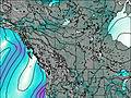
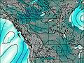
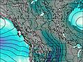
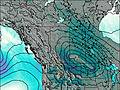
This table gives the weather forecast for Forum Peak at the specific elevation of 2415 m. Our advanced weather models allow us to provide distinct weather forecasts for several elevations of Forum Peak. To see the weather forecasts for the other elevations, use the tab navigation above the table. For a wider overview of the weather, consult the Weather Map of Alberta.
| Weather Station | Temp. | Weather | Wind | Gusts | Cloud / Visibility |
|---|---|---|---|---|---|
WatertonParkGate- Alta | |||||
Bullhorn Headwaters- Alta | |||||
Carway- Alta | |||||
Glenwood- Alta | |||||
Pincher Creek- Alta | |||||
Pincher Creek Airport | |||||
Bullhorn Coulee Reservoir- Alta |
* NOTE: not all weather observatories update at the same frequency which is the reason why some locations may show data from stations that are further away than known closer ones.
Forum Peak Photos
View all
Canadian Rockies photos (92) |
photos from mountains in Canada (454) |
all photos
 Upload new photo
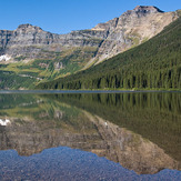
Forum Peak