
– Lat/Long: 60.46° N 10.94° E
 Fjellsjøkampen (Fjellsjokampen)
Weather Forecast, NorwayIssued: 7 am Tue 09 Jun Local TimeUpdates in: hr min sUpdate imminent
Issued: 7 am Tue 09 Jun Local Time
Updates in:
Update imminent hr min s

Issued: 7 am Tue 09 Jun Local Time
Updates in:
Update imminent hr min s
Days 1–3 Weather SummaryHeavy rain (total 27mm), heaviest during Tue afternoon. Very mild (max 11°C on Wed afternoon, min 5°C on Wed morning). Winds decreasing (strong winds from the SE on Tue afternoon, light winds from the WSW by Thu night). | Days 4–6 Weather SummaryLight rain (total 8mm), mostly falling on Sun afternoon. Very mild (max 14°C on Sat afternoon, min 6°C on Sat night). Winds increasing (light winds from the WSW on Sat morning, fresh winds from the N by Sun night). | |||||||||||||||||
Tuesday 9 | Wednesday 10 | Thursday 11 | Friday 12 | Saturday 13 | Sunday 14 | |||||||||||||
AM | PM | night | AM | PM | night | AM | PM | night | AM | PM | night | AM | PM | night | AM | PM | night | |
light rain | mod. rain | mod. rain | light rain | light rain | rain shwrs | rain shwrs | risk tstorm | risk tstorm | some clouds | cloudy | some clouds | rain shwrs | rain shwrs | clear | clear | rain shwrs | rain shwrs | |
km/h | ||||||||||||||||||
 |  |  |  |  |  | |||||||||||||
— | — | — | — | — | — | — | — | — | — | — | — | — | — | — | — | — | — | |
1.4 | 10 | 6 | 2 | 0.5 | 4 | 0.2 | 0.7 | 1.4 | — | — | — | 0.7 | 0.4 | — | — | 4 | 2 | |
max °C | 10 | 10 | 8 | 8 | 11 | 7 | 8 | 11 | 9 | 10 | 13 | 11 | 11 | 14 | 12 | 9 | 10 | 7 |
min °C | 9 | 9 | 6 | 5 | 10 | 6 | 7 | 9 | 6 | 8 | 12 | 8 | 9 | 13 | 6 | 7 | 7 | 6 |
6 | 4 | 4 | 0 | 7 | 4 | 5 | 6 | 4 | 6 | 10 | 5 | 8 | 11 | 2 | 4 | 4 | 1 | |
2450 | 2500 | 2000 | 1800 | 2050 | 1950 | 1800 | 2000 | 2050 | 2200 | 2450 | 2300 | 2200 | 2300 | 2050 | 1900 | 1850 | 1850 | |
Cloud base (m) | 350 | 300 | 400 | 550 | 2100 | 550 | 650 | 2150 | 5250 | 2200 | 2300 | 2050 | 2050 | 2300 | 2150 | 1800 | 700 | 800 |
3:50 | — | — | 3:49 | — | — | 3:48 | — | — | 3:48 | — | — | 3:47 | — | — | 3:47 | — | — | |
— | — | 10:39 | — | — | 10:40 | — | — | 10:42 | — | — | 10:43 | — | — | 10:44 | — | — | 10:45 | |
Loading...
Fjellsjøkampen Weather (Days 0-3):
The weather forecast for Fjellsjøkampen is: Heavy rain (total 27mm), heaviest during Tue afternoon. Very mild (max 11°C on Wed afternoon, min 5°C on Wed morning). Winds decreasing (strong winds from the SE on Tue afternoon, light winds from the WSW by Thu night).
Fjellsjøkampen Weather (Days 3-6):
Light rain (total 8mm), mostly falling on Sun afternoon. Very mild (max 14°C on Sat afternoon, min 6°C on Sat night). Winds increasing (light winds from the WSW on Sat morning, fresh winds from the N by Sun night).
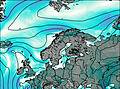
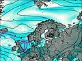
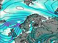
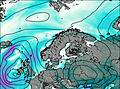
This table gives the weather forecast for Fjellsjøkampen at the specific elevation of 812 m. Our advanced weather models allow us to provide distinct weather forecasts for several elevations of Fjellsjøkampen. To see the weather forecasts for the other elevations, use the tab navigation above the table. For a wider overview of the weather, consult the Weather Map of Norway.
* NOTE: not all weather observatories update at the same frequency which is the reason why some locations may show data from stations that are further away than known closer ones.