– Lat/Long: 43.27° S 146.48° E
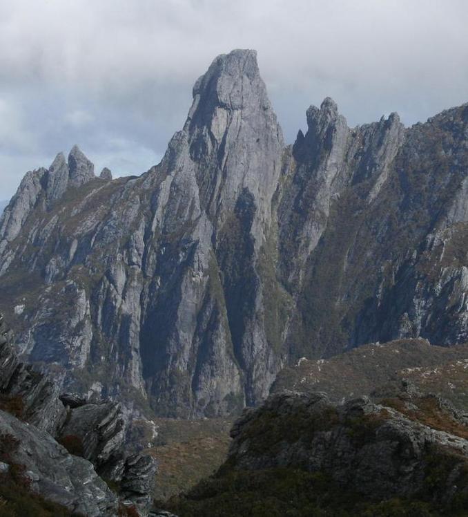
 Federation Peak
Weather Forecast, AustraliaIssued: 9 pm Fri 19 Apr Local TimeUpdates in: hr min sUpdate imminent
Federation PeakWeather Forecast, Australia
Issued: 9 pm Fri 19 Apr Local Time
Updates in:
Update imminent hr min s

Issued: 9 pm Fri 19 Apr Local Time
Updates in:
Update imminent hr min s
Days 1–4 Weather SummaryMostly dry. Mild temperatures (max 9°C on Sat morning, min 4°C on Sun morning). Winds increasing (moderate winds from the WSW on Fri night, strong winds from the W by Sat night). | Days 5–7 Weather SummaryA moderate fall of snow, heaviest on Wed morning. Turning milder with moderate rain (total 11mm), heaviest on Wed afternoon. Freeze-thaw conditions (max 9°C on Tue night, min -2°C on Wed night). Winds increasing (light winds from the WNW on Tue night, gales from the WSW by Wed night). | Days 8–10 Weather SummaryLight rain (total 5mm), mostly falling on Thu night. Mild temperatures (max 5°C on Thu night, min 1°C on Sat night). Winds decreasing (near gales from the WSW on Thu night, light winds from the W by Fri night). | Days 11–13 Weather SummaryLight rain (total 3mm), mostly falling on Wed night. Mild temperatures (max 7°C on Wed morning, min 4°C on Sun night). Winds decreasing (strong winds from the WNW on Tue night, light winds from the NW by Wed afternoon). | |||||||||||||||||||||||||||||||||
Saturday 20 | Sunday 21 | Monday 22 | Tuesday 23 | Wednesday 24 | Thursday 25 | Friday 26 | Saturday 27 | Sunday 28 | Monday 29 | Tuesday 30 | Wed 1 | |||||||||||||||||||||||||
night | AM | PM | night | AM | PM | night | AM | PM | night | AM | PM | night | AM | PM | night | AM | PM | night | AM | PM | night | AM | PM | night | AM | PM | night | AM | PM | night | AM | PM | night | AM | PM | |
some clouds | clear | some clouds | some clouds | some clouds | rain shwrs | some clouds | some clouds | rain shwrs | some clouds | rain shwrs | cloudy | light rain | mod. snow | light snow | cloudy | cloudy | cloudy | light rain | light rain | rain shwrs | rain shwrs | light rain | light rain | light rain | light rain | light rain | some clouds | light rain | light rain | light rain | cloudy | light rain | rain shwrs | rain shwrs | rain shwrs | |
km/h | ||||||||||||||||||||||||||||||||||||
Wave Height Map |  |  |  |  |  |  |  |  |  | 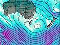 | 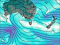 | 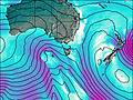 | 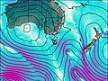 | |||||||||||||||||||||||
— | — | — | — | — | — | — | — | — | — | — | — | — | 10 | 1.0 | — | — | — | — | — | — | — | — | — | — | — | — | — | — | — | — | — | — | — | — | — | |
— | — | — | — | — | 0.1 | — | — | 0.1 | — | 0.1 | — | 1.8 | — | 9 | — | — | — | 3 | 0.3 | 0.1 | 0.1 | 0.1 | 0.1 | 0.4 | 0.1 | 0.2 | — | 0.2 | 0.3 | 0.2 | — | 0.5 | 0.3 | 0.1 | 0.5 | |
max°C | 8 | 9 | 8 | 8 | 6 | 8 | 9 | 7 | 6 | 6 | 5 | 7 | 9 | 0 | 2 | -1 | -1 | 1 | 5 | 5 | 5 | 4 | 4 | 4 | 3 | 3 | 4 | 5 | 5 | 5 | 5 | 6 | 6 | 6 | 7 | 7 |
min°C | 7 | 9 | 8 | 5 | 4 | 8 | 8 | 6 | 5 | 4 | 5 | 6 | 4 | 0 | 0 | -2 | -1 | 0 | 2 | 5 | 5 | 4 | 4 | 4 | 1 | 2 | 3 | 4 | 4 | 4 | 4 | 6 | 6 | 5 | 7 | 6 |
3 | 5 | 4 | -1 | -2 | 4 | 4 | 0 | -1 | -3 | -1 | 2 | 2 | -8 | -9 | -12 | -10 | -8 | -6 | 0 | 0 | -1 | 0 | 0 | -6 | -4 | -3 | -1 | -2 | -1 | -1 | 1 | 0 | -1 | 3 | 2 | |
3000 | 3100 | 3150 | 3300 | 3400 | 3300 | 3500 | 3650 | 3400 | 3550 | 3200 | 2750 | 2550 | 1300 | 1700 | 1050 | 1100 | 1300 | 1900 | 2850 | 2950 | 2500 | 2250 | 2200 | 2000 | 1500 | 1850 | 2150 | 2300 | 2350 | 2300 | 2350 | 2300 | 2450 | 2400 | 2400 | |
Cloud base (m) | 400 | 650 | 9000 | 500 | 600 | 700 | 700 | 650 | 700 | 6700 | 550 | 300 | 350 | 350 | 400 | 350 | 400 | 450 | 650 | 750 | 800 | 500 | 750 | 600 | 700 | 700 | 750 | 2050 | 650 | 900 | 750 | 650 | 850 | |||
— | 6:52 | — | — | 6:52 | — | — | 6:54 | — | — | 6:56 | — | — | 6:56 | — | — | 6:58 | — | — | 6:58 | — | — | 7:00 | — | — | 7:01 | — | — | 7:03 | — | — | 7:03 | — | — | 7:05 | — | |
— | — | 5:31 | — | — | 5:30 | — | — | 5:29 | — | — | 5:28 | — | — | 5:25 | — | — | 5:24 | — | — | 5:22 | — | — | 5:22 | — | — | 5:20 | — | — | 5:19 | — | — | 5:16 | — | — | 5:15 | |
Federation Peak Weather (Days 0-3):
The weather forecast for Federation Peak is: Mostly dry. Mild temperatures (max 9°C on Sat morning, min 4°C on Sun morning). Winds increasing (moderate winds from the WSW on Fri night, strong winds from the W by Sat night).
Federation Peak Weather (Days 3-6):
A moderate fall of snow, heaviest on Wed morning. Turning milder with moderate rain (total 11mm), heaviest on Wed afternoon. Freeze-thaw conditions (max 9°C on Tue night, min -2°C on Wed night). Winds increasing (light winds from the WNW on Tue night, gales from the WSW by Wed night).
Federation Peak Weather (Days 6-9):
Light rain (total 5mm), mostly falling on Thu night. Mild temperatures (max 5°C on Thu night, min 1°C on Sat night). Winds decreasing (near gales from the WSW on Thu night, light winds from the W by Fri night).
This table gives the weather forecast for Federation Peak at the specific elevation of 1274 m. Our advanced weather models allow us to provide distinct weather forecasts for several elevations of Federation Peak. To see the weather forecasts for the other elevations, use the tab navigation above the table. For a wider overview of the weather, consult the Weather Map of Tasmania.
Federation Peak Photos
View all
Frankland Range (Tasmania) photos (2) |
Other ranges of Australia photos (69) |
photos from mountains in Australia (208) |
all photos
 Upload new photo
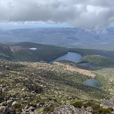
Mt Picton looking south to lake riveaux and Mt Hartz
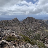
mt Picton
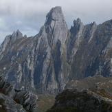
Federation Peak
 Like us
 Follow us
