– Lat/Long: 29.25° N 103.30° W
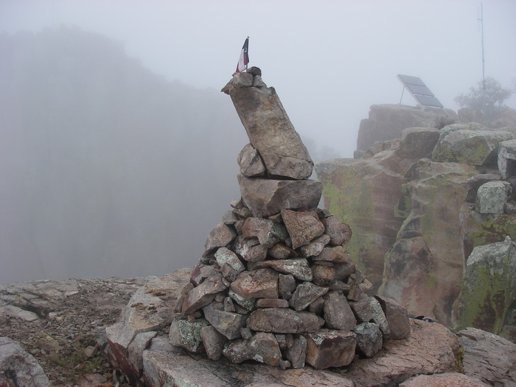
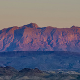
 Emory Peak
Weather Forecast, United StatesIssued: 12 am Tue 09 Jun Local TimeUpdates in: hr min sUpdate imminent
Issued: 12 am Tue 09 Jun Local Time
Updates in:
Update imminent hr min s

Issued: 12 am Tue 09 Jun Local Time
Updates in:
Update imminent hr min s
Days 1–4 Weather SummaryMostly dry. Warm (max 23°C on Thu afternoon, min 17°C on Mon night). Wind will be generally light. | Days 5–7 Weather SummaryLight rain (total 4mm), mostly falling on Thu night. Warm (max 20°C on Thu night, min 15°C on Fri night). Winds decreasing (fresh winds from the SE on Fri night, calm by Sun morning). | ||||||||||||||||||
Tuesday 9 | Wednesday 10 | Thursday 11 | Friday 12 | Saturday 13 | Sunday 14 | ||||||||||||||
night | AM | PM | night | AM | PM | night | AM | PM | night | AM | PM | night | AM | PM | night | AM | PM | night | |
clear | clear | rain shwrs | risk tstorm | clear | clear | some clouds | some clouds | clear | risk tstorm | some clouds | some clouds | clear | clear | clear | clear | clear | risk tstorm | risk tstorm | |
km/h | |||||||||||||||||||
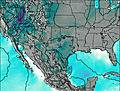 | 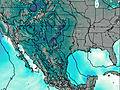 | 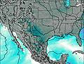 |  |  |  |  | |||||||||||||
— | — | — | — | — | — | — | — | — | — | — | — | — | — | — | — | — | — | — | |
— | — | 0.3 | 0.5 | — | — | — | — | — | 2 | — | — | — | — | — | — | — | 1.2 | 1.2 | |
max °C | 19 | 18 | 20 | 19 | 20 | 22 | 21 | 20 | 23 | 20 | 18 | 19 | 18 | 18 | 20 | 19 | 19 | 20 | 18 |
min °C | 17 | 17 | 19 | 18 | 18 | 21 | 19 | 19 | 22 | 17 | 16 | 19 | 15 | 16 | 19 | 17 | 17 | 19 | 17 |
17 | 17 | 19 | 18 | 18 | 21 | 19 | 19 | 22 | 17 | 15 | 19 | 15 | 16 | 19 | 17 | 17 | 19 | 17 | |
5450 | 5350 | 5300 | 5450 | 5400 | 5450 | 5450 | 5400 | 5300 | 5400 | 5100 | 5200 | 5300 | 5200 | 5200 | 5400 | 5250 | 5300 | 5350 | |
Cloud base (m) | 5450 | 4150 | 9450 | 6500 | 6950 | 4800 | 6850 | 3950 | 6550 | 7100 | 9850 | 3200 | 3050 | ||||||
— | 6:52 | — | — | 6:52 | — | — | 6:52 | — | — | 6:52 | — | — | 6:52 | — | — | 6:52 | — | — | |
— | — | 8:51 | — | — | 8:52 | — | — | 8:52 | — | — | 8:52 | — | — | 8:52 | — | — | 8:52 | — | |
Loading...
Emory Peak Weather (Days 0-3):
The weather forecast for Emory Peak is: Mostly dry. Warm (max 23°C on Thu afternoon, min 17°C on Mon night). Wind will be generally light.
Emory Peak Weather (Days 3-6):
Light rain (total 4mm), mostly falling on Thu night. Warm (max 20°C on Thu night, min 15°C on Fri night). Winds decreasing (fresh winds from the SE on Fri night, calm by Sun morning).
This table gives the weather forecast for Emory Peak at the specific elevation of 2385 m. Our advanced weather models allow us to provide distinct weather forecasts for several elevations of Emory Peak. To see the weather forecasts for the other elevations, use the tab navigation above the table. For a wider overview of the weather, consult the Weather Map of Texas.
| Weather Station | Temp. | Weather | Wind | Gusts | Cloud / Visibility |
|---|---|---|---|---|---|
Presidio Lely International Airport (Texas) | |||||
Dryden | |||||
Marfa Airport | |||||
Fort Stockton Airport | |||||
* NOTE: not all weather observatories update at the same frequency which is the reason why some locations may show data from stations that are further away than known closer ones.
Emory Peak Photos
View all
Southwest Basins and Ranges photos (27) |
Intermountain West photos (151) |
photos from mountains in United States (3050) |
all photos
 Upload new photo
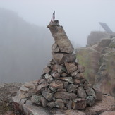
Emory Peak
Emory Peak