– Lat/Long: 47.28° N 9.41° E
 Ebenalp
Weather Forecast, SwitzerlandIssued: 7 pm Fri 19 Apr Local TimeUpdates in: hr min sUpdate imminent
EbenalpWeather Forecast, Switzerland
Issued: 7 pm Fri 19 Apr Local Time
Updates in:
Update imminent hr min s

Issued: 7 pm Fri 19 Apr Local Time
Updates in:
Update imminent hr min s
Days 1–4 Weather SummaryA heavy fall of snow, heaviest during Fri night. Temperatures will be below freezing (max -2°C on Fri night, min -6°C on Sat morning). Winds decreasing (strong winds from the W on Fri night, light winds from the NNW by Sun morning). | Days 5–7 Weather SummaryA light covering of new snow mostly falling on Tue morning. Freeze-thaw conditions (max 1°C on Thu afternoon, min -6°C on Tue morning). Wind will be generally light. | ||||||||||||||||||
Saturday 20 | Sunday 21 | Monday 22 | Tuesday 23 | Wednesday 24 | Thursday 25 | ||||||||||||||
night | AM | PM | night | AM | PM | night | AM | PM | night | AM | PM | night | AM | PM | night | AM | PM | night | |
heavy snow | light snow | light snow | light snow | light snow | light snow | light snow | light snow | cloudy | some clouds | light snow | snow shwrs | snow shwrs | snow shwrs | some clouds | cloudy | cloudy | cloudy | light snow | |
km/h | |||||||||||||||||||
Wave Height Map |  |  |  |  |  |  |  | ||||||||||||
16 | 4 | 4 | 4 | 5 | 2.0 | 1.0 | 1.0 | — | — | 1.0 | 1.0 | 3 | 1.0 | — | — | — | — | 3 | |
— | — | — | — | — | — | — | — | — | — | — | — | — | — | — | — | — | — | — | |
max°C | -2 | -6 | -4 | -4 | -6 | -5 | -5 | -6 | -5 | -4 | -6 | -4 | -4 | -4 | -2 | -2 | -1 | 1 | -1 |
min°C | -5 | -6 | -5 | -5 | -6 | -5 | -6 | -6 | -6 | -5 | -6 | -4 | -5 | -5 | -3 | -3 | -2 | 0 | -1 |
-12 | -12 | -10 | -9 | -11 | -9 | -9 | -10 | -10 | -9 | -9 | -7 | -8 | -8 | -7 | -7 | -6 | -4 | -6 | |
1150 | 900 | 1050 | 750 | 850 | 950 | 800 | 700 | 1000 | 550 | 850 | 1150 | 850 | 1050 | 1400 | 1100 | 1450 | 1650 | 1450 | |
Cloud base (m) | 700 | 700 | 700 | 750 | 700 | 700 | 700 | 700 | 700 | 750 | 700 | 1450 | 750 | 700 | 1600 | 700 | 2400 | 1600 | 700 |
— | 6:24 | — | — | 6:22 | — | — | 6:20 | — | — | 6:18 | — | — | 6:16 | — | — | 6:15 | — | — | |
— | — | — | 8:17 | — | — | 8:20 | — | — | 8:21 | — | — | 8:22 | — | — | 8:23 | — | — | 8:24 | |
Ebenalp Weather (Days 0-3):
The weather forecast for Ebenalp is: A heavy fall of snow, heaviest during Fri night. Temperatures will be below freezing (max -2°C on Fri night, min -6°C on Sat morning). Winds decreasing (strong winds from the W on Fri night, light winds from the NNW by Sun morning).
Ebenalp Weather (Days 3-6):
A light covering of new snow mostly falling on Tue morning. Freeze-thaw conditions (max 1°C on Thu afternoon, min -6°C on Tue morning). Wind will be generally light.
This table gives the weather forecast for Ebenalp at the specific elevation of 1640 m. Our advanced weather models allow us to provide distinct weather forecasts for several elevations of Ebenalp. To see the weather forecasts for the other elevations, use the tab navigation above the table. For a wider overview of the weather, consult the Weather Map of Switzerland.
| Weather Station | Temp. | Weather | Wind | Gusts | Cloud / Visibility |
|---|---|---|---|---|---|
Saentis | |||||
Urnäsch | |||||
Studnerberg | |||||
Stockberg |
* NOTE: not all weather observatories update at the same frequency which is the reason why some locations may show data from stations that are further away than known closer ones.
Ebenalp Photos
View all
Glarus Alps photos (60) |
Alps photos (1434) |
photos from mountains in Switzerland (632) |
all photos
 Upload new photo
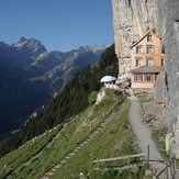
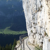
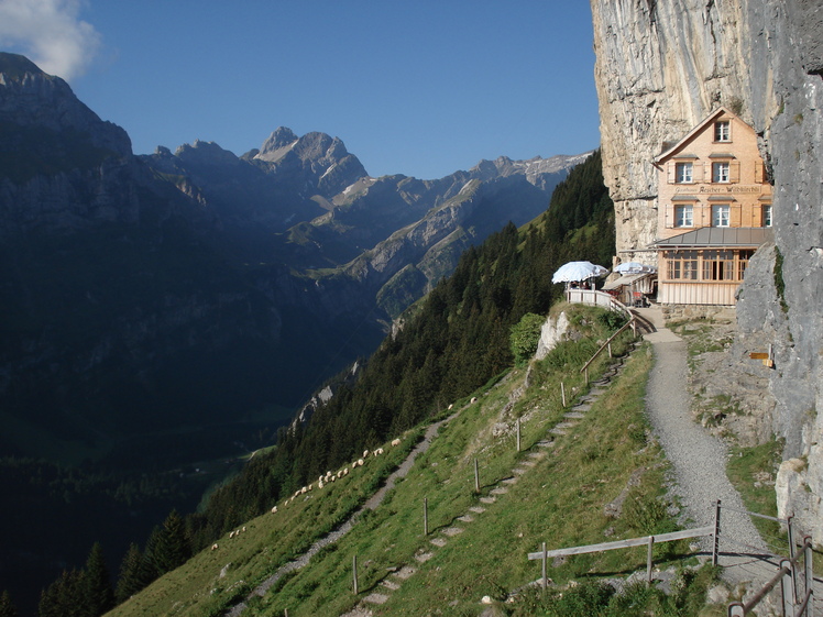
Ascher-Inn
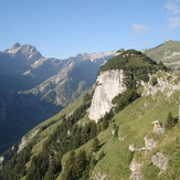
Ebenalp
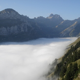
Ebenalp
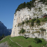
Wildkirchli path
Ebenalp
 Like us
 Follow us
