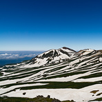
August 26, 2017, strong wind, heavy rain, hike aborted.
The plan was to do a traverse of Daisetsu (大雪山) which would take about 8 hours, but was aborted just 1 hour after start due to gale force wind and heavy rain. However, I think it is still worth to share my experience, especially I did quite a bit of research for this hike.
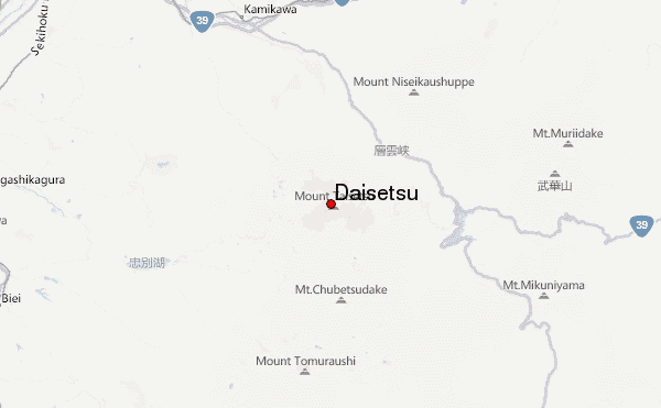
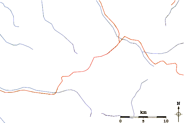
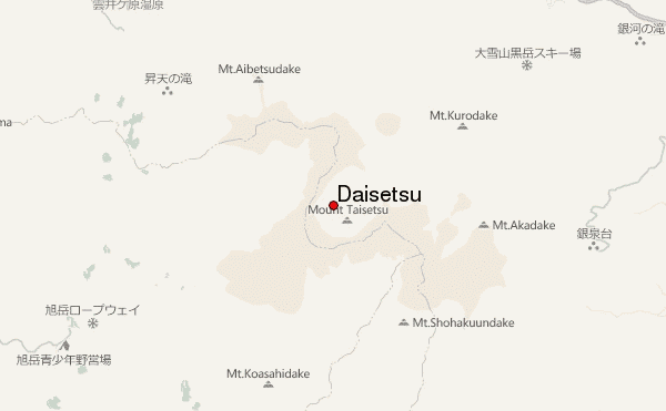
Among the many peaks of Daisetsu, there are two that could be reached quite easily. In the south is Asahidake (旭岳), which is the highest peak at 2,291m. A ropeway run from Asahidake Onsen (旭岳温泉) to Sugatami (姿見) at about 1,600m. The hike to the summit was thus just a 700m ascend. I have hiked this peak a few years back in early July, which took me 4-5 hours return. I will consider it safe and is easy-moderate difficulty level. Main concern is just that the trail is rather exposed and need to prepare for strong sun/wind.
In the north is Kurodake (黒岳) at 1984m. A ropeway that starts at Sounkyo (層雲峡) Onsen followed by chairlift could take you to the 7th station at 1,520m, leaving only 464m to the summit and is where I start this time. It is a rather fast ascend, mostly stairs, with some trees that provide shades. The trail is safe and a return trip to the summit should take just 2-3 hours. However, due to gale force wind and heavy rain, I decided to turn back for safety reason at the 9th station (about 1,800m).
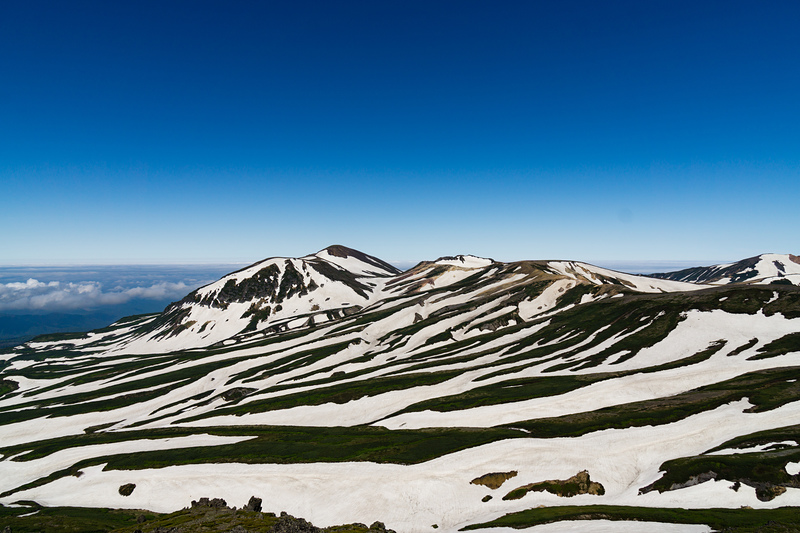
While hiking the individual peak is easy, the traverse is a challenge because it is an additional 4 hours on barren terrain with no supply. There are also sections that may still be covered by snow or need to cross streams formed by melted snow, and cannot be passed with ordinary hiking gears. The worst case will be after 6 hours of hike, you encountered such section and need to turn back.
The start and finish points are far apart, so unless you carry everything with you, travelling logistic is an issue. There are buses from JR Asahikawa (旭川) station to both Asahidake Onsen (4 times daily) and Sounkyo Onsen (7 times daily). Even you start very early (first ropeway on both side start at 6:30am during summer), you have to finish your hike (include time for ropeways which is >1hr) before 1:30pm for north bound or 2:30pm for south bound.
My decision was pack light and carry everything with me so I don't have to spend hours travelling back to my hotel after the long hike. Another option is to carry just what you need for one night and send the rest by courier to Asahikawa where you can pick up the next day.
Another major decision is northbound or southbound. The typical wind in Hokkaido is from the south so it will be pushing you when you go northbound. You also don't have to worry about ropeway closure due to strong wind when you "arrived" the other end, and need to hike another 2 hours down the mountain. Nevertheless, southbound also had its advantage that Sounkyo Onsen had an excellent Visitor Center, where people there speaks very good English and had professional knowledge of the hiking trails and its latest condition and weather forecast. (Note: Sounkyo Onsen had a "Tourist Information" near the bus station which is of very little help. The "Visitor Center" is located near the ropeway station so don't get mixed up.)
Finally, the real hiking experience! I choose late August
and hope there will be less snow at the top. Overnight at Sounkyo Onsen and took the southbound route. I was not aware of the wind factor at that time and the reason for southbound is because I had hiked Asahidake before and know the trail is safe and easy, and thus I won't risk facing an unfamiliar difficult trail towards the end of the hike.
People at the Visitor Centre already warned me of possible severe weather at the top, and when I say I just want to buy a one way ticket at the Kurodake ropeway, staff immediately warned me about bad weather and possible closure of ropeway at the Asahidake side. With these warnings, I decided to change my plan to just go up Kurodake and hike as far as I could and then turn back.
I took the 7:10am ropeway, then chairlift afterward and arrived the 7th station at around 7:50am. Weather is still okay and being in the leeward side, there is not much wind. However, it started to rain at around 8:15am and keep get heavier and wind also grow stronger as I ascend. Decided to turn back at the 9th station, which is just about 15 minutes from the peak.
I think I will try this hike again in the future. I will stay in Asahikawa (lots of hotels so finding rooms is not a problem even in summer time) and go to Asahidake Onsen the day before only when I see the weather is ok.
 Daisetsu – Climbing, Hiking & Mountaineering information
 Like us
 Follow us
