– Lat/Long: 54.88° N 2.58° W
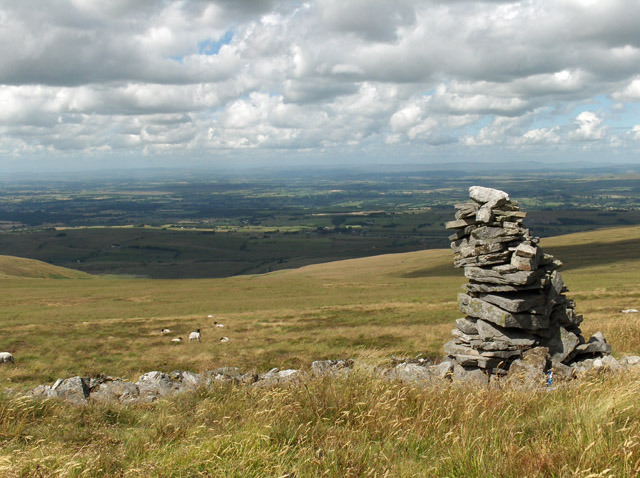
 Cold Fell (Calder Bridge)
Weather Forecast, United KingdomIssued: 12 am Tue 09 Jun Local TimeUpdates in: hr min sUpdate imminent
Issued: 12 am Tue 09 Jun Local Time
Updates in:
Update imminent hr min s

Issued: 12 am Tue 09 Jun Local Time
Updates in:
Update imminent hr min s
Days 1–4 Weather SummaryLight rain (total 8mm), mostly falling on Tue afternoon. Very mild (max 11°C on Thu morning, min 5°C on Tue night). Wind will be generally light. | Days 5–7 Weather SummarySome drizzle, heaviest during Thu night. Warm (max 22°C on Sun morning, min 10°C on Thu night). Wind will be generally light. | ||||||||||||||||||
Tuesday 9 | Wednesday 10 | Thursday 11 | Friday 12 | Saturday 13 | Sunday 14 | ||||||||||||||
night | AM | PM | night | AM | PM | night | AM | PM | night | AM | PM | night | AM | PM | night | AM | PM | night | |
rain shwrs | rain shwrs | risk tstorm | rain shwrs | light rain | light rain | rain shwrs | cloudy | light rain | light rain | cloudy | rain shwrs | rain shwrs | cloudy | cloudy | some clouds | clear | risk tstorm | some clouds | |
km/h | |||||||||||||||||||
 |  |  |  |  |  |  | |||||||||||||
— | — | — | — | — | — | — | — | — | — | — | — | — | — | — | — | — | — | — | |
0.3 | 1.7 | 2 | 0.2 | 1.2 | 2 | 0.3 | — | 0.1 | 0.9 | — | 0.2 | 0.4 | — | — | — | — | 0.1 | — | |
max °C | 8 | 8 | 9 | 7 | 9 | 10 | 7 | 11 | 11 | 12 | 14 | 15 | 15 | 19 | 19 | 16 | 22 | 22 | 18 |
min °C | 7 | 8 | 9 | 5 | 8 | 9 | 5 | 10 | 11 | 10 | 12 | 14 | 14 | 17 | 18 | 14 | 19 | 22 | 16 |
4 | 4 | 6 | 2 | 5 | 6 | 3 | 8 | 9 | 8 | 10 | 12 | 12 | 16 | 18 | 14 | 19 | 22 | 16 | |
1600 | 1300 | 1350 | 1450 | 1300 | 1500 | 1650 | 1900 | 2850 | 3350 | 3200 | 3650 | 3550 | 3500 | 3500 | 3500 | 3500 | 3650 | 3650 | |
Cloud base (m) | 1850 | 400 | 550 | 5750 | 550 | 550 | 750 | 250 | 350 | 200 | 400 | 250 | 450 | 250 | 5450 | 850 | |||
— | 4:33 | — | — | 4:33 | — | — | 4:33 | — | — | 4:31 | — | — | 4:31 | — | — | 4:31 | — | — | |
— | — | 9:45 | — | — | 9:45 | — | — | 9:46 | — | — | 9:47 | — | — | 9:47 | — | — | 9:49 | — | |
Loading...
Cold Fell (Calder Bridge) Weather (Days 0-3):
The weather forecast for Cold Fell (Calder Bridge) is: Light rain (total 8mm), mostly falling on Tue afternoon. Very mild (max 11°C on Thu morning, min 5°C on Tue night). Wind will be generally light.
Cold Fell (Calder Bridge) Weather (Days 3-6):
Some drizzle, heaviest during Thu night. Warm (max 22°C on Sun morning, min 10°C on Thu night). Wind will be generally light.
This table gives the weather forecast for Cold Fell (Calder Bridge) at the specific elevation of 293 m. Our advanced weather models allow us to provide distinct weather forecasts for several elevations of Cold Fell (Calder Bridge). To see the weather forecasts for the other elevations, use the tab navigation above the table. For a wider overview of the weather, consult the Weather Map of United Kingdom.
| Weather Station | Temp. | Weather | Wind | Gusts | Cloud / Visibility |
|---|---|---|---|---|---|
Spadeadam Airport | |||||
Shap | |||||
Newcastle Airport | |||||
Wether Fell | |||||
Witchieknowe | |||||
Newbiggin Waverider |
* NOTE: not all weather observatories update at the same frequency which is the reason why some locations may show data from stations that are further away than known closer ones.
Cold Fell (Calder Bridge) Photos
View all
North Pennines photos (18) |
Pennines photos (197) |
photos from mountains in United Kingdom (2122) |
all photos
 Upload new photo
Cold Fell (Calder Bridge)