
– Lat/Long: 49.93° N 123.04° W
 Clinker Peak
Weather Forecast, CanadaIssued: 10 pm Thu 18 Apr Local TimeUpdates in: hr min sUpdate imminent
Clinker PeakWeather Forecast, Canada
Issued: 10 pm Thu 18 Apr Local Time
Updates in:
Update imminent hr min s

Issued: 10 pm Thu 18 Apr Local Time
Updates in:
Update imminent hr min s
Days 1–4 Weather SummaryMild with light rain (total 2mm) on Sat afternoon Becoming colder with a light covering of snow, mostly falling on Sat night. Freeze-thaw conditions (max 10°C on Sat afternoon, min -1°C on Sat night). Wind will be generally light. | Days 5–7 Weather SummaryA light covering of new snow mostly falling on Tue night. Becoming milder with light rain (total 6mm) on Wed afternoon. Very mild (max 13°C on Tue afternoon, min 1°C on Sun night). Wind will be generally light. | ||||||||||||||||||
Friday 19 | Saturday 20 | Sunday 21 | Monday 22 | Tuesday 23 | Wednesday 24 | ||||||||||||||
night | AM | PM | night | AM | PM | night | AM | PM | night | AM | PM | night | AM | PM | night | AM | PM | night | |
clear | clear | some clouds | clear | some clouds | light rain | light snow | snow shwrs | rain shwrs | rain shwrs | clear | clear | some clouds | cloudy | cloudy | mod. snow | light snow | light rain | some clouds | |
km/h | |||||||||||||||||||
Wave Height Map |  | 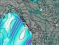 | 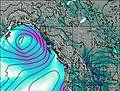 | 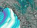 | 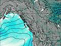 | 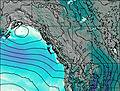 | 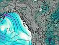 | ||||||||||||
— | — | — | — | — | — | 5 | 1.0 | — | — | — | — | — | — | — | 6 | 2.0 | — | — | |
— | — | — | — | — | 0.9 | — | — | 1.5 | 0.4 | — | — | — | — | — | 1.5 | — | 4 | — | |
max°C | 4 | 5 | 8 | 6 | 8 | 10 | 2 | 1 | 3 | 2 | 5 | 9 | 8 | 9 | 13 | 11 | 2 | 2 | 2 |
min°C | 2 | 3 | 7 | 4 | 5 | 4 | -1 | 0 | 2 | 1 | 2 | 8 | 6 | 6 | 12 | 2 | 1 | 2 | 0 |
-1 | 1 | 6 | 3 | 4 | 1 | -4 | -3 | -1 | 1 | 0 | 8 | 4 | 5 | 12 | -2 | -2 | -1 | 0 | |
1650 | 1650 | 1950 | 1850 | 2100 | 1650 | 950 | 1200 | 1450 | 1250 | 1650 | 2200 | 2300 | 2400 | 2550 | 2000 | 1300 | 1300 | 1150 | |
Cloud base (m) | 3000 | 3100 | 2300 | 900 | 950 | 950 | 1000 | 1500 | 2350 | 5800 | 6400 | 1900 | 900 | 900 | 900 | ||||
— | 6:09 | — | — | 6:07 | — | — | 6:05 | — | — | 6:03 | — | — | 6:01 | — | — | 6:00 | — | — | |
— | — | — | 8:13 | — | — | 8:14 | — | — | 8:15 | — | — | 8:16 | — | — | 8:19 | — | — | 8:21 | |
Clinker Peak Weather (Days 0-3):
The weather forecast for Clinker Peak is: Mild with light rain (total 2mm) on Sat afternoon Becoming colder with a light covering of snow, mostly falling on Sat night. Freeze-thaw conditions (max 10°C on Sat afternoon, min -1°C on Sat night). Wind will be generally light.
Clinker Peak Weather (Days 3-6):
A light covering of new snow mostly falling on Tue night. Becoming milder with light rain (total 6mm) on Wed afternoon. Very mild (max 13°C on Tue afternoon, min 1°C on Sun night). Wind will be generally light.
This table gives the weather forecast for Clinker Peak at the specific elevation of 1000 m. Our advanced weather models allow us to provide distinct weather forecasts for several elevations of Clinker Peak. To see the weather forecasts for the other elevations, use the tab navigation above the table. For a wider overview of the weather, consult the Weather Map of British-Columbia.
 Like us
 Follow us
