– Lat/Long: 34.74° N 83.94° W
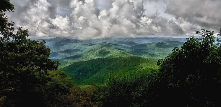
 Blood Mountain
Weather Forecast, United StatesIssued: 7 pm Mon 08 Jun Local TimeUpdates in: hr min sUpdate imminent
Issued: 7 pm Mon 08 Jun Local Time
Updates in:
Update imminent hr min s

Issued: 7 pm Mon 08 Jun Local Time
Updates in:
Update imminent hr min s
Days 1–4 Weather SummaryHeavy rain (total 43mm), heaviest during Mon night. Warm (max 22°C on Thu afternoon, min 17°C on Mon night). Wind will be generally light. | Days 5–7 Weather SummaryLight rain (total 8mm), mostly falling on Sat night. Warm (max 23°C on Sat afternoon, min 18°C on Sun morning). Winds decreasing (fresh winds from the NW on Fri morning, light winds from the S by Sat night). | ||||||||||||||||||
Tuesday 9 | Wednesday 10 | Thursday 11 | Friday 12 | Saturday 13 | Sunday 14 | ||||||||||||||
night | AM | PM | night | AM | PM | night | AM | PM | night | AM | PM | night | AM | PM | night | AM | PM | night | |
heavy rain | rain shwrs | risk tstorm | risk tstorm | clear | mod. rain | risk tstorm | clear | light rain | risk tstorm | rain shwrs | some clouds | some clouds | rain shwrs | rain shwrs | risk tstorm | light rain | light rain | risk tstorm | |
km/h | |||||||||||||||||||
 |  |  |  |  |  |  | |||||||||||||
— | — | — | — | — | — | — | — | — | — | — | — | — | — | — | — | — | — | — | |
18 | 1.7 | 10 | 1.5 | — | 8 | 2 | — | 0.7 | 1.5 | 0.1 | — | — | 0.1 | 0.1 | 4 | 1.2 | 0.8 | 4 | |
max °C | 18 | 17 | 18 | 18 | 17 | 19 | 19 | 19 | 22 | 21 | 20 | 22 | 22 | 21 | 23 | 21 | 18 | 18 | 18 |
min °C | 17 | 17 | 17 | 18 | 17 | 19 | 19 | 19 | 22 | 20 | 20 | 22 | 21 | 20 | 23 | 19 | 18 | 18 | 17 |
17 | 17 | 17 | 18 | 17 | 19 | 19 | 19 | 22 | 20 | 20 | 22 | 21 | 20 | 23 | 19 | 18 | 18 | 17 | |
4550 | 4500 | 4550 | 4650 | 4550 | 4700 | 4800 | 4700 | 4650 | 4750 | 4650 | 4650 | 4750 | 4750 | 4800 | 4750 | 4550 | 4550 | 4600 | |
Cloud base (m) | 550 | 1750 | 700 | 550 | 750 | 850 | 8800 | 2000 | 2150 | 5950 | 4600 | 750 | 1900 | 2400 | |||||
— | 6:22 | — | — | 6:22 | — | — | 6:20 | — | — | 6:20 | — | — | 6:20 | — | — | 6:20 | — | — | |
— | — | — | 8:46 | — | — | 8:47 | — | — | 8:47 | — | — | 8:49 | — | — | 8:49 | — | — | 8:50 | |
Loading...
Blood Mountain Weather (Days 0-3):
The weather forecast for Blood Mountain is: Heavy rain (total 43mm), heaviest during Mon night. Warm (max 22°C on Thu afternoon, min 17°C on Mon night). Wind will be generally light.
Blood Mountain Weather (Days 3-6):
Light rain (total 8mm), mostly falling on Sat night. Warm (max 23°C on Sat afternoon, min 18°C on Sun morning). Winds decreasing (fresh winds from the NW on Fri morning, light winds from the S by Sat night).
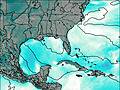
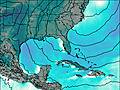
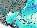
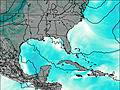
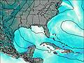
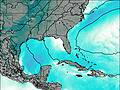
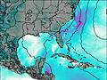
This table gives the weather forecast for Blood Mountain at the specific elevation of 1360 m. Our advanced weather models allow us to provide distinct weather forecasts for several elevations of Blood Mountain. To see the weather forecasts for the other elevations, use the tab navigation above the table. For a wider overview of the weather, consult the Weather Map of Georgia-USA.
| Weather Station | Temp. | Weather | Wind | Gusts | Cloud / Visibility |
|---|---|---|---|---|---|
Blairsville Municipal Airport (Georgia) | |||||
* NOTE: not all weather observatories update at the same frequency which is the reason why some locations may show data from stations that are further away than known closer ones.
Blood Mountain Photos
View all
Blue Ridge Mountains photos (162) |
Appalachians photos (907) |
photos from mountains in United States (3050) |
all photos
 Upload new photo


 See 20 more Blood Mountain photos
Blood Mountain Summit Summer 2018
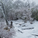
an Icy Peak
Sunset
Sunset
Sunset
Sunset
Sunset at Blood Mountain