
– Lat/Long: 61.45° N 7.85° E
 Austadbotntind-Riingstind
Weather Forecast, NorwayIssued: 7 pm Tue 09 Jun Local TimeUpdates in: hr min sUpdate imminent
Issued: 7 pm Tue 09 Jun Local Time
Updates in:
Update imminent hr min s

Issued: 7 pm Tue 09 Jun Local Time
Updates in:
Update imminent hr min s
Days 1–4 Weather SummaryA moderate fall of snow, heaviest on Tue night. Temperatures will be below freezing (max 0°C on Tue night, min -5°C on Wed morning). Winds decreasing (fresh winds from the WNW on Wed morning, light winds from the WSW by Thu night). | Days 5–7 Weather SummaryA dusting of new snow. Freeze-thaw conditions (max 2°C on Mon afternoon, min -4°C on Fri night). Winds decreasing (fresh winds from the WSW on Fri night, calm by Sat night). | ||||||||||||||||||
Wednesday 10 | Thursday 11 | Friday 12 | Saturday 13 | Sunday 14 | Monday 15 | ||||||||||||||
night | AM | PM | night | AM | PM | night | AM | PM | night | AM | PM | night | AM | PM | night | AM | PM | night | |
heavy snow | cloudy | light snow | some clouds | some clouds | some clouds | some clouds | cloudy | some clouds | cloudy | some clouds | some clouds | snow shwrs | some clouds | clear | clear | some clouds | clear | some clouds | |
km/h | |||||||||||||||||||
 |  |  |  |  |  |  | |||||||||||||
12 | — | 1 | — | — | — | — | — | — | — | — | — | 2 | — | — | — | — | — | — | |
— | — | — | — | — | — | — | — | — | — | — | — | — | — | — | — | — | — | — | |
max °C | 0 | -5 | -5 | -5 | -4 | -2 | -2 | -3 | -1 | -1 | -3 | -1 | -1 | -1 | 1 | 1 | 1 | 2 | 2 |
min °C | -4 | -5 | -5 | -5 | -5 | -3 | -4 | -4 | -2 | -4 | -4 | -2 | -4 | -3 | 0 | -1 | -1 | 2 | 1 |
-9 | -12 | -14 | -13 | -10 | -7 | -10 | -10 | -7 | -10 | -9 | -6 | -4 | -10 | -5 | -5 | -5 | -2 | -2 | |
1450 | 1350 | 1400 | 1450 | 1650 | 1950 | 1750 | 1800 | 2050 | 1700 | 1800 | 2050 | 1550 | 2000 | 2300 | 2200 | 2350 | 2450 | 2400 | |
Cloud base (m) | 700 | 700 | 700 | 700 | 850 | 2100 | 5600 | 1800 | 1900 | 800 | 1450 | 2000 | 800 | 850 | 1900 | 1950 | 1950 | 2550 | 2550 |
— | 3:49 | — | — | 3:49 | — | — | 3:48 | — | — | 3:47 | — | — | 3:47 | — | — | 3:47 | — | — | |
— | — | — | 11:05 | — | — | 11:07 | — | — | 11:07 | — | — | 11:08 | — | — | 11:09 | — | — | 11:10 | |
Loading...
Austadbotntind-Riingstind Weather (Days 0-3):
The weather forecast for Austadbotntind-Riingstind is: A moderate fall of snow, heaviest on Tue night. Temperatures will be below freezing (max 0°C on Tue night, min -5°C on Wed morning). Winds decreasing (fresh winds from the WNW on Wed morning, light winds from the WSW by Thu night).
Austadbotntind-Riingstind Weather (Days 3-6):
A dusting of new snow. Freeze-thaw conditions (max 2°C on Mon afternoon, min -4°C on Fri night). Winds decreasing (fresh winds from the WSW on Fri night, calm by Sat night).
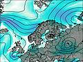
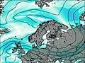
This table gives the weather forecast for Austadbotntind-Riingstind at the specific elevation of 2204 m. Our advanced weather models allow us to provide distinct weather forecasts for several elevations of Austadbotntind-Riingstind. To see the weather forecasts for the other elevations, use the tab navigation above the table. For a wider overview of the weather, consult the Weather Map of Norway.
| Weather Station | Temp. | Weather | Wind | Gusts | Cloud / Visibility |
|---|---|---|---|---|---|
Filefjell | |||||
Modvaberget | |||||
Tylderingen | |||||
Sogndal AP | |||||
Brata -Slettom | |||||
Beitostolen II | |||||
Huksdalen |
* NOTE: not all weather observatories update at the same frequency which is the reason why some locations may show data from stations that are further away than known closer ones.