
– Lat/Long: 52.99° S 73.30° E
 Anzac Peak
Weather Forecast, AustraliaIssued: 4 pm Sat 20 Apr Local TimeUpdates in: hr min sUpdate imminent
Anzac PeakWeather Forecast, Australia
Issued: 4 pm Sat 20 Apr Local Time
Updates in:
Update imminent hr min s

Issued: 4 pm Sat 20 Apr Local Time
Updates in:
Update imminent hr min s
Days 1–4 Weather SummaryModerate rain (total 11mm), heaviest on Sun afternoon. Mild temperatures (max 6°C on Sat night, min 3°C on Sat afternoon). Winds decreasing (gales from the W on Sun night, strong winds from the NNW by Mon night). | Days 5–7 Weather SummaryLight rain (total 7mm), mostly falling on Tue night. Temperatures will be slightly above freezing (max 4°C on Thu night, min 1°C on Wed afternoon). Mainly near gales. | Days 8–10 Weather SummaryModerate rain (total 15mm), heaviest on Sun night. Mild temperatures (max 6°C on Sat night, min 2°C on Mon morning). Winds decreasing (gales from the NNW on Sun morning, moderate winds from the W by Mon morning). | Days 11–13 Weather SummaryModerate rain (total 14mm), heaviest on Wed night. Freeze-thaw conditions (max 2°C on Mon afternoon, min -1°C on Tue night). Winds increasing (light winds from the SSW on Mon afternoon, gales from the SSW by Tue night). | |||||||||||||||||||||||||||||||||
Sat 20 | Sunday 21 | Monday 22 | Tuesday 23 | Wednesday 24 | Thursday 25 | Friday 26 | Saturday 27 | Sunday 28 | Monday 29 | Tuesday 30 | Wednesday 1 | Thu 2 | ||||||||||||||||||||||||
PM | night | AM | PM | night | AM | PM | night | AM | PM | night | AM | PM | night | AM | PM | night | AM | PM | night | AM | PM | night | AM | PM | night | AM | PM | night | AM | PM | night | AM | PM | night | AM | |
rain shwrs | light rain | light rain | light rain | rain shwrs | rain shwrs | light rain | light rain | rain shwrs | rain shwrs | light rain | light rain | rain shwrs | rain shwrs | light rain | light rain | rain shwrs | some clouds | light rain | light rain | light rain | light rain | light rain | light rain | light rain | light rain | light rain | rain shwrs | rain shwrs | light rain | light rain | rain shwrs | rain shwrs | rain shwrs | light rain | light rain | |
km/h | ||||||||||||||||||||||||||||||||||||
Wave Height Map | 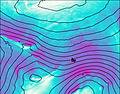 | 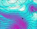 | 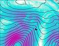 | 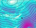 | 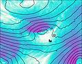 | 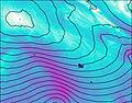 | 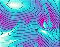 | 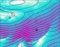 |  |  |  |  |  | |||||||||||||||||||||||
— | — | — | — | — | — | — | — | — | — | — | — | — | — | — | — | — | — | — | — | — | — | — | — | — | — | — | — | — | — | — | — | — | — | — | — | |
0.2 | 1.3 | 3 | 5 | 0.9 | 0.2 | 0.2 | 0.2 | 0.7 | 0.7 | 2 | 1.2 | 0.8 | 0.9 | 0.6 | 0.5 | 0.3 | — | 1.2 | 2 | 0.1 | 0.8 | 4 | 2 | 1.1 | 3 | 0.3 | 0.1 | 0.2 | 0.4 | 1.3 | 4 | 0.9 | 0.2 | 4 | 2 | |
max°C | 3 | 6 | 6 | 5 | 3 | 4 | 4 | 4 | 3 | 2 | 2 | 2 | 1 | 2 | 2 | 3 | 4 | 4 | 3 | 4 | 5 | 5 | 6 | 6 | 5 | 6 | 2 | 2 | 1 | 0 | 1 | 0 | 0 | 0 | 2 | 2 |
min°C | 3 | 3 | 6 | 3 | 3 | 4 | 4 | 3 | 3 | 2 | 2 | 2 | 1 | 1 | 2 | 3 | 3 | 3 | 3 | 3 | 5 | 5 | 4 | 6 | 5 | 3 | 2 | 1 | 0 | 0 | 0 | -1 | 0 | 0 | 0 | 2 |
-4 | -4 | 0 | -5 | -5 | -3 | -3 | -4 | -3 | -6 | -6 | -6 | -7 | -7 | -6 | -4 | -4 | -5 | -5 | -4 | -2 | -2 | -2 | -1 | -1 | -5 | -5 | -4 | -6 | -6 | -7 | -10 | -8 | -7 | -5 | -4 | |
1650 | 2200 | 2000 | 400 | 350 | 500 | 500 | 450 | 350 | 250 | 200 | 200 | 150 | 200 | 300 | 500 | 650 | 1800 | 2000 | 1750 | 1600 | 1300 | 1500 | 1350 | 950 | 550 | 300 | 200 | 50 | 50 | 50 | 0 | 0 | 50 | 0 | 250 | |
Cloud base (m) | 400 | 100 | 0 | 250 | 300 | 250 | 50 | 350 | 100 | 50 | 350 | 350 | 250 | 150 | 250 | 550 | 150 | 200 | 800 | 150 | 250 | 0 | 250 | 550 | 50 | 0 | 300 | 350 | 200 | 400 | 250 | 500 | 300 | |||
— | — | 7:05 | — | — | 7:07 | — | — | 7:09 | — | — | 7:11 | — | — | 7:11 | — | — | 7:13 | — | — | 7:16 | — | — | 7:16 | — | — | 7:18 | — | — | 7:20 | — | — | 7:22 | — | — | 7:24 | |
5:06 | — | — | 5:04 | — | — | 5:00 | — | — | 4:59 | — | — | 4:57 | — | — | 4:54 | — | — | 4:52 | — | — | 4:51 | — | — | 4:49 | — | — | 4:46 | — | — | 4:45 | — | — | 4:43 | — | — | |
Anzac Peak Weather (Days 0-3):
The weather forecast for Anzac Peak is: Moderate rain (total 11mm), heaviest on Sun afternoon. Mild temperatures (max 6°C on Sat night, min 3°C on Sat afternoon). Winds decreasing (gales from the W on Sun night, strong winds from the NNW by Mon night).
Anzac Peak Weather (Days 3-6):
Light rain (total 7mm), mostly falling on Tue night. Temperatures will be slightly above freezing (max 4°C on Thu night, min 1°C on Wed afternoon). Mainly near gales.
Anzac Peak Weather (Days 6-9):
Moderate rain (total 15mm), heaviest on Sun night. Mild temperatures (max 6°C on Sat night, min 2°C on Mon morning). Winds decreasing (gales from the NNW on Sun morning, moderate winds from the W by Mon morning).
This table gives the weather forecast for Anzac Peak at the specific elevation of 0 m. Our advanced weather models allow us to provide distinct weather forecasts for several elevations of Anzac Peak. To see the weather forecasts for the other elevations, use the tab navigation above the table. For a wider overview of the weather, consult the Weather Map of Heard Island and McDonald Islands.
| Weather Station | Temp. | Weather | Wind | Gusts | Cloud / Visibility |
|---|---|---|---|---|---|
Port-Aux-Francais (Iles Kerguelen) | |||||
Alfred Faure (Iles Crozet) | |||||
Mawson | |||||
Martin DE Vivies (Ile Amsterdam) | |||||
SHIP11349 |
* NOTE: not all weather observatories update at the same frequency which is the reason why some locations may show data from stations that are further away than known closer ones.
 Like us
 Follow us
