– Lat/Long: 45.89° N 6.91° E
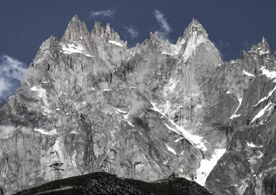
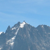
 Aiguille du Plan
Weather Forecast, FranceIssued: 7 pm Tue 23 Apr Local TimeUpdates in: hr min sUpdate imminent
Aiguille du PlanWeather Forecast, France
Issued: 7 pm Tue 23 Apr Local Time
Updates in:
Update imminent hr min s

Issued: 7 pm Tue 23 Apr Local Time
Updates in:
Update imminent hr min s
Days 1–4 Weather SummaryA light covering of new snow mostly falling on Wed night. Temperatures will be well below freezing (max -7°C on Fri afternoon, min -13°C on Tue night). Wind will be generally light. | Days 5–7 Weather SummaryA dusting of new snow. Temperatures will be below freezing (max -1°C on Mon morning, min -7°C on Fri night). Wind will be generally light. | ||||||||||||||||||
Wednesday 24 | Thursday 25 | Friday 26 | Saturday 27 | Sunday 28 | Monday 29 | ||||||||||||||
night | AM | PM | night | AM | PM | night | AM | PM | night | AM | PM | night | AM | PM | night | AM | PM | night | |
light snow | some clouds | light snow | snow shwrs | clear | some clouds | clear | cloudy | light snow | snow shwrs | clear | cloudy | some clouds | cloudy | cloudy | cloudy | some clouds | some clouds | clear | |
km/h | |||||||||||||||||||
Wave Height Map |  |  |  |  |  |  |  | ||||||||||||
1.0 | — | 1.0 | 4 | — | — | — | — | 2.0 | 1.0 | — | — | — | — | — | — | — | — | — | |
— | — | — | — | — | — | — | — | — | — | — | — | — | — | — | — | — | — | — | |
max°C | -13 | -13 | -12 | -12 | -10 | -9 | -8 | -9 | -7 | -6 | -6 | -5 | -3 | -4 | -4 | -2 | -1 | -1 | 0 |
min°C | -13 | -13 | -12 | -13 | -11 | -9 | -9 | -9 | -8 | -7 | -6 | -6 | -4 | -4 | -4 | -3 | -2 | -1 | -1 |
-20 | -20 | -18 | -19 | -15 | -12 | -14 | -14 | -12 | -10 | -11 | -12 | -9 | -9 | -9 | -8 | -6 | -5 | -5 | |
650 | 1200 | 1550 | 800 | 1450 | 1950 | 1350 | 1900 | 2100 | 1450 | 2100 | 2300 | 2150 | 2400 | 2500 | 2450 | 2750 | 2900 | 2950 | |
Cloud base (m) | 2250 | 2250 | 2300 | 2250 | 2250 | 2550 | 2250 | 2350 | 2450 | 2400 | 2400 | 2500 | 2300 | 2350 | 2500 | 2350 | 2350 | 2750 | 2550 |
— | 6:30 | — | — | 6:28 | — | — | 6:26 | — | — | 6:24 | — | — | 6:22 | — | — | 6:22 | — | — | |
— | — | — | 8:30 | — | — | 8:31 | — | — | 8:34 | — | — | 8:35 | — | — | 8:36 | — | — | 8:37 | |
Aiguille du Plan Weather (Days 0-3):
The weather forecast for Aiguille du Plan is: A light covering of new snow mostly falling on Wed night. Temperatures will be well below freezing (max -7°C on Fri afternoon, min -13°C on Tue night). Wind will be generally light.
Aiguille du Plan Weather (Days 3-6):
A dusting of new snow. Temperatures will be below freezing (max -1°C on Mon morning, min -7°C on Fri night). Wind will be generally light.
This table gives the weather forecast for Aiguille du Plan at the specific elevation of 3000 m. Our advanced weather models allow us to provide distinct weather forecasts for several elevations of Aiguille du Plan. To see the weather forecasts for the other elevations, use the tab navigation above the table. For a wider overview of the weather, consult the Weather Map of France.
Aiguille du Plan Photos
View all
Savoy Alps photos (118) |
Alps photos (1434) |
photos from mountains in France (267) |
all photos
 Upload new photo
Gigants
Aiguille du Plan
 Like us
 Follow us
