This is a popular easy round trip day hike where you will see many other hikers even on weekdays. This is my second time hiking this mountain.
Date: July 25, 2019 (Thursday)
Weather: Mostly cloudy
Temperature: around mid 20s
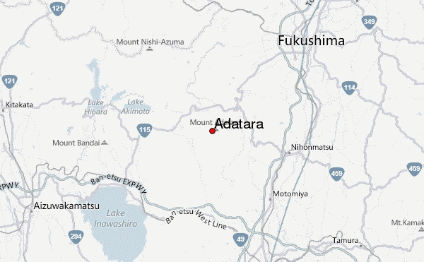
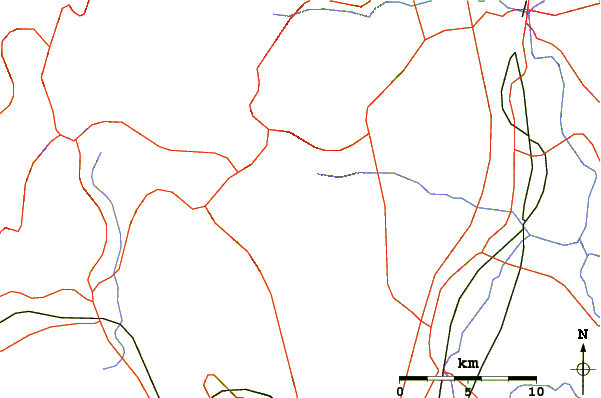
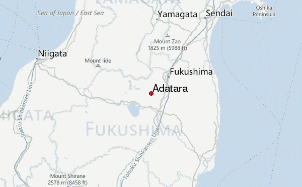
Start/Finish: Adatara Kogen Ski Resort (あだたら高原リゾート)
Access:
Dake Onsen (岳温泉 500m) is an onsen village with a few hotels about 6km from the trail head. There are frequent buses (takes about 30min) between Dake Onsen and Nihommatsu (二本松) station, which can be reached by taking Shinkansen to either Koriyama (郡山) station or Fukushiima (福島) station and then local train.
However, buses to/from the trail head was limited: 3 times daily at 08:45, 09:55, 12:50 to the trail head and twice daily back at 12:20 and 15:30. In 2019, the bus runs on weekends and holiday only between April 20 and Sep 29, and daily between October 1 and November 4.
The route:
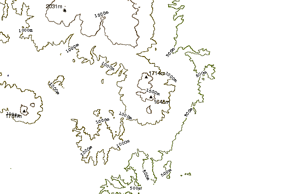
There are two routes going up Mount Adatara (1,700m). The easy one is take the gondola from the ski resort (950m) to an elevation of about 1,350m, follow by an easy hike of about 1h15m to the peak just before the boulder.
The other route is skip the gondola and hike all the way up, which was not as difficult as it sounds. The first 1.5h was on easy gentle slope with good shades and takes you to a house (Kurogane Goya Mountain Lodge
くろがね小屋) at 1350m that sells basic food and drinks (it is supposed to open daily but don’t count on it 100%). The trail then turned rougher (but still safe), steeper and more exposed and takes about 1.5h to reach the peak before the boulder.
While the boulder was just 20m high, going up is like climbing. The "trail" is narrow and steep and need to hold on to the chains attached to the rock.
Our hike:
My previous hike was up without the gondola. This time, we took the most popular route: up by the gondola and down without. It took us 1h15m from the upper gondola station to reach the boulder, but we decided to skip climbing the boulder.
After a brief lunch break, we take a short side trip to near Yahazumori (矢筈森, 1673m) for the stunning view of the crater and then reconnect the descend trail (actually this side trail appear to be easier than the main trail). With the side trip, it was about 1h to the house and from there another 1h15m back to the ski resort.
If you plan to come down by gondola, take note that the last ride to the ski resort is at 16:20.
 Adatara – Climbing, Hiking & Mountaineering information
 Like us
 Follow us
