– Lat/Long: 57.23° N 5.16° W
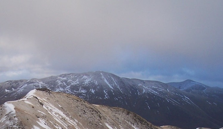
 A' Chràlaig
Weather Forecast, United KingdomIssued: 6 pm Thu 18 Apr Local TimeUpdates in: hr min sUpdate imminent
A' ChràlaigWeather Forecast, United Kingdom
Issued: 6 pm Thu 18 Apr Local Time
Updates in:
Update imminent hr min s

Issued: 6 pm Thu 18 Apr Local Time
Updates in:
Update imminent hr min s
Days 1–4 Weather SummaryA dusting of new snow. Freeze-thaw conditions (max 7°C on Sun morning, min -3°C on Thu night). Winds decreasing (near gales from the WNW on Thu afternoon, light winds from the NNW by Sun morning). | Days 5–7 Weather SummaryMostly dry. Freeze-thaw conditions (max 7°C on Sun afternoon, min -4°C on Tue night). Wind will be generally light. | Days 8–10 Weather SummaryA dusting of new snow. Temperatures will be below freezing (max -1°C on Thu afternoon, min -4°C on Wed night). Winds decreasing (fresh winds from the NE on Wed night, calm by Fri morning). | Days 11–13 Weather SummaryA dusting of snow turning to light rain (total 3mm) on Mon night. Freeze-thaw conditions (max 5°C on Tue morning, min -1°C on Sat night). Winds increasing (calm on Sun afternoon, strong winds from the E by Tue morning). | |||||||||||||||||||||||||||||||||
Thu 18 | Friday 19 | Saturday 20 | Sunday 21 | Monday 22 | Tuesday 23 | Wednesday 24 | Thursday 25 | Friday 26 | Saturday 27 | Sunday 28 | Monday 29 | Tue 30 | ||||||||||||||||||||||||
PM | night | AM | PM | night | AM | PM | night | AM | PM | night | AM | PM | night | AM | PM | night | AM | PM | night | AM | PM | night | AM | PM | night | AM | PM | night | AM | PM | night | AM | PM | night | AM | |
light snow | cloudy | cloudy | cloudy | some clouds | some clouds | some clouds | some clouds | some clouds | cloudy | some clouds | some clouds | cloudy | rain shwrs | clear | clear | some clouds | some clouds | some clouds | some clouds | cloudy | snow shwrs | light snow | cloudy | light snow | cloudy | some clouds | cloudy | some clouds | cloudy | cloudy | light snow | cloudy | light snow | light rain | light rain | |
km/h | ||||||||||||||||||||||||||||||||||||
Wave Height Map |  |  |  |  |  |  |  |  |  |  |  |  |  | |||||||||||||||||||||||
1.0 | — | — | — | — | — | — | — | — | — | — | — | — | — | — | — | — | — | — | — | — | 1.0 | 1.0 | — | 2.0 | — | — | — | — | — | — | 1.0 | — | 1.0 | — | — | |
— | — | — | — | — | — | — | — | — | — | — | — | — | 0.1 | — | — | — | — | — | — | — | — | — | — | — | — | — | — | — | — | — | — | — | 0.5 | 2 | 0.7 | |
max°C | 2 | 0 | -3 | -2 | -1 | 3 | 3 | 4 | 7 | 7 | 6 | 5 | 5 | 4 | 2 | 2 | -1 | -3 | -3 | -3 | -2 | -1 | -3 | -2 | -1 | -2 | -1 | 0 | 0 | 0 | 1 | 1 | 2 | 2 | 4 | 5 |
min°C | 1 | -3 | -3 | -3 | -3 | 1 | 3 | 4 | 6 | 7 | 4 | 5 | 5 | 2 | 1 | 1 | -4 | -4 | -3 | -4 | -3 | -2 | -3 | -3 | -2 | -3 | -3 | 0 | -1 | -1 | 1 | 1 | 1 | 1 | 2 | 4 |
-7 | -11 | -10 | -10 | -10 | -3 | 0 | 0 | 5 | 6 | 0 | 1 | 2 | -3 | -3 | -4 | -11 | -11 | -10 | -12 | -8 | -7 | -7 | -3 | -4 | -7 | -7 | -2 | -5 | -5 | 1 | -5 | -6 | -6 | -4 | -2 | |
1400 | 1100 | 750 | 850 | 700 | 1300 | 1550 | 2050 | 2150 | 2150 | 2200 | 2100 | 1900 | 1450 | 1350 | 1350 | 700 | 700 | 800 | 600 | 800 | 1000 | 700 | 750 | 1000 | 750 | 800 | 1150 | 1000 | 1000 | 1250 | 1300 | 1300 | 1300 | 1600 | 2000 | |
Cloud base (m) | 350 | 400 | 400 | 600 | 650 | 1000 | 950 | 900 | 2300 | 900 | 2950 | 700 | 750 | 550 | 950 | 500 | 550 | 700 | 500 | 500 | 700 | 650 | 350 | 550 | 300 | 500 | 750 | 650 | 400 | 750 | 500 | 400 | 350 | 350 | 400 | |
— | — | 6:00 | — | — | 5:56 | — | — | 5:54 | — | — | 5:52 | — | — | 5:50 | — | — | 5:47 | — | — | 5:45 | — | — | 5:41 | — | — | 5:39 | — | — | 5:37 | — | — | 5:35 | — | — | 5:33 | |
8:37 | — | — | 8:39 | — | — | 8:42 | — | — | 8:44 | — | — | 8:45 | — | — | 8:47 | — | — | 8:51 | — | — | 8:52 | — | — | 8:54 | — | — | 8:57 | — | — | 8:59 | — | — | 9:00 | — | — | |
A' Chràlaig Weather (Days 0-3):
The weather forecast for A' Chràlaig is: A dusting of new snow. Freeze-thaw conditions (max 7°C on Sun morning, min -3°C on Thu night). Winds decreasing (near gales from the WNW on Thu afternoon, light winds from the NNW by Sun morning).
A' Chràlaig Weather (Days 3-6):
Mostly dry. Freeze-thaw conditions (max 7°C on Sun afternoon, min -4°C on Tue night). Wind will be generally light.
A' Chràlaig Weather (Days 6-9):
A dusting of new snow. Temperatures will be below freezing (max -1°C on Thu afternoon, min -4°C on Wed night). Winds decreasing (fresh winds from the NE on Wed night, calm by Fri morning).
This table gives the weather forecast for A' Chràlaig at the specific elevation of 1120 m. Our advanced weather models allow us to provide distinct weather forecasts for several elevations of A' Chràlaig. To see the weather forecasts for the other elevations, use the tab navigation above the table. For a wider overview of the weather, consult the Weather Map of United Kingdom.
 Like us
 Follow us
